Downloaded 55 times
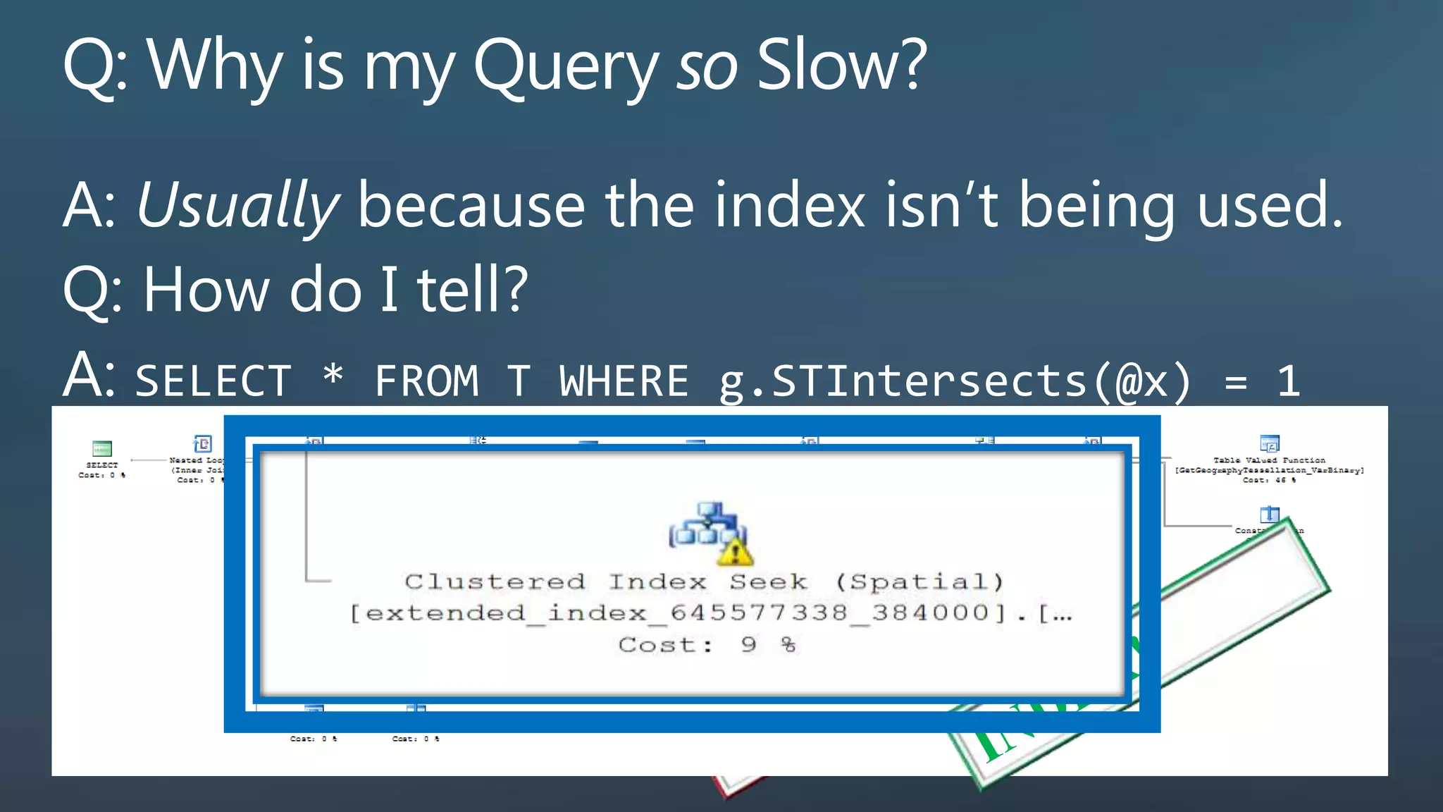
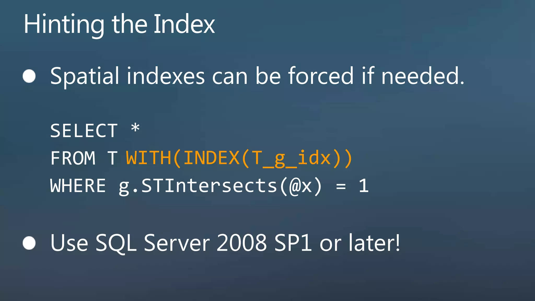
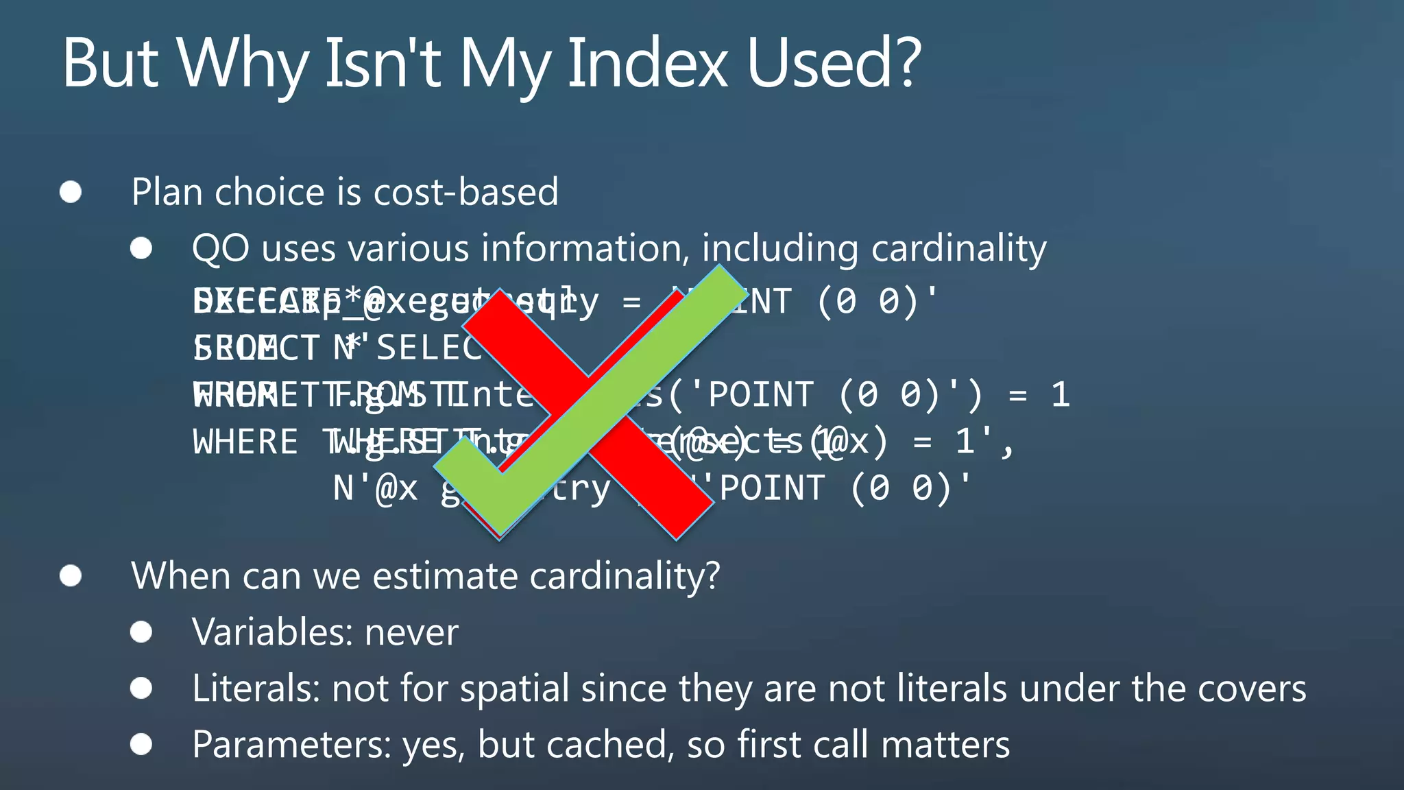
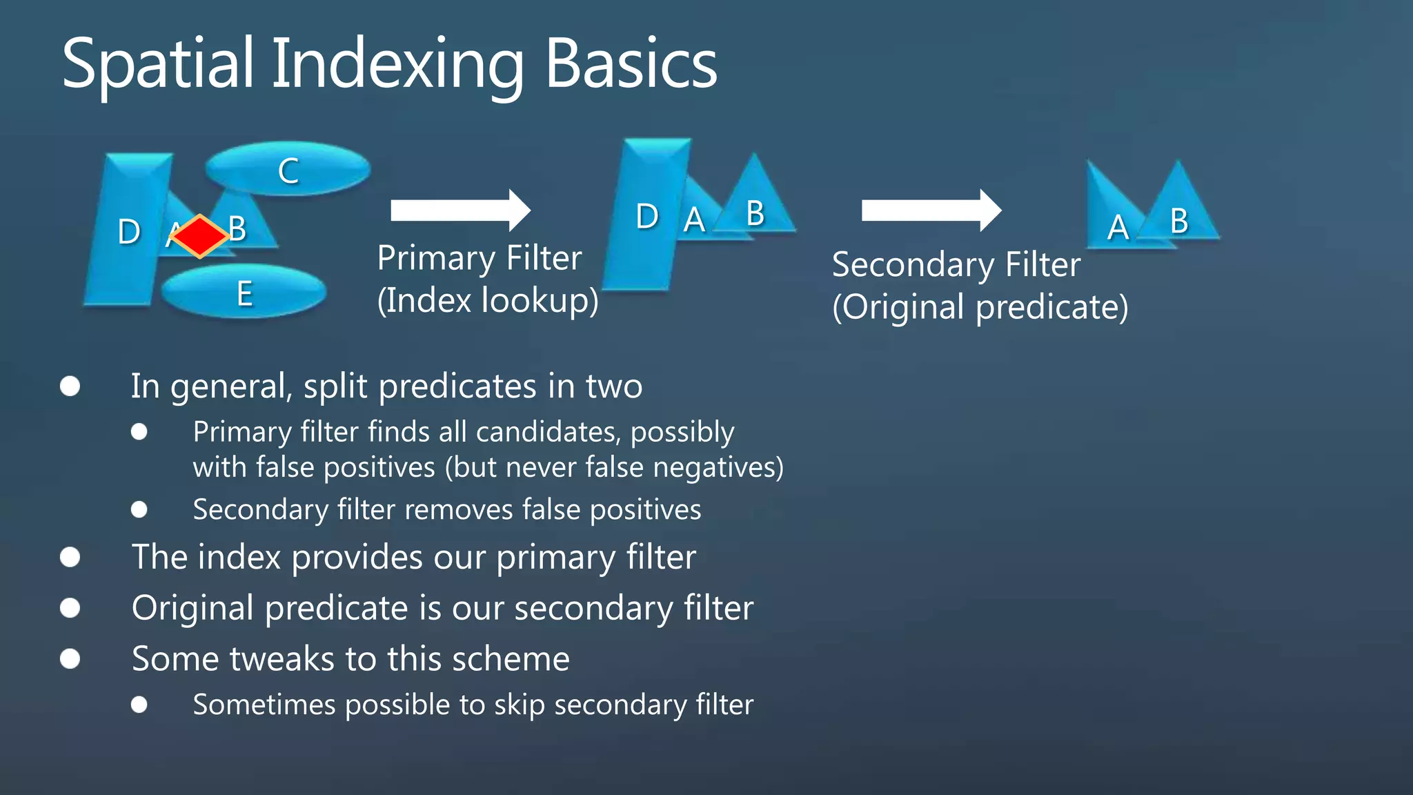
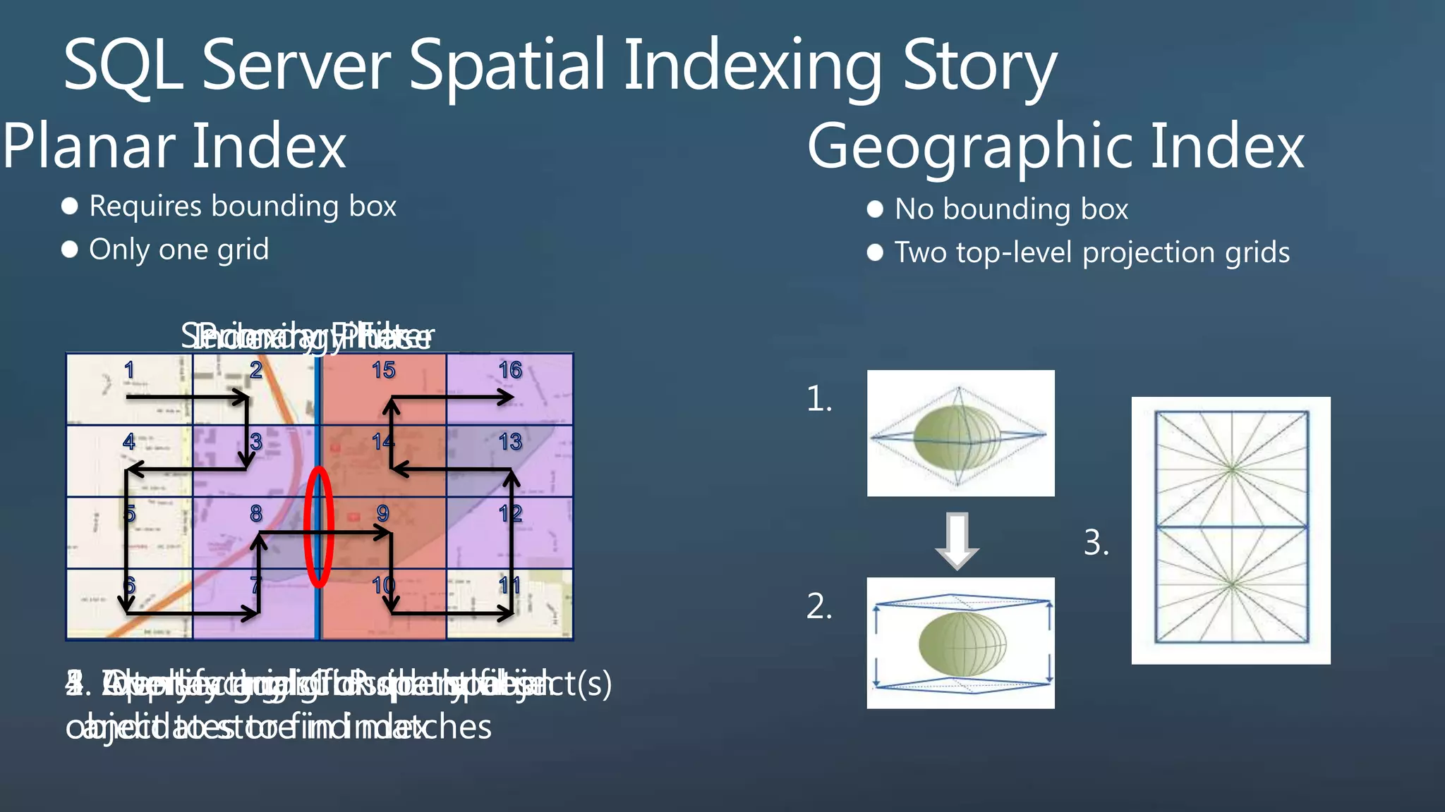
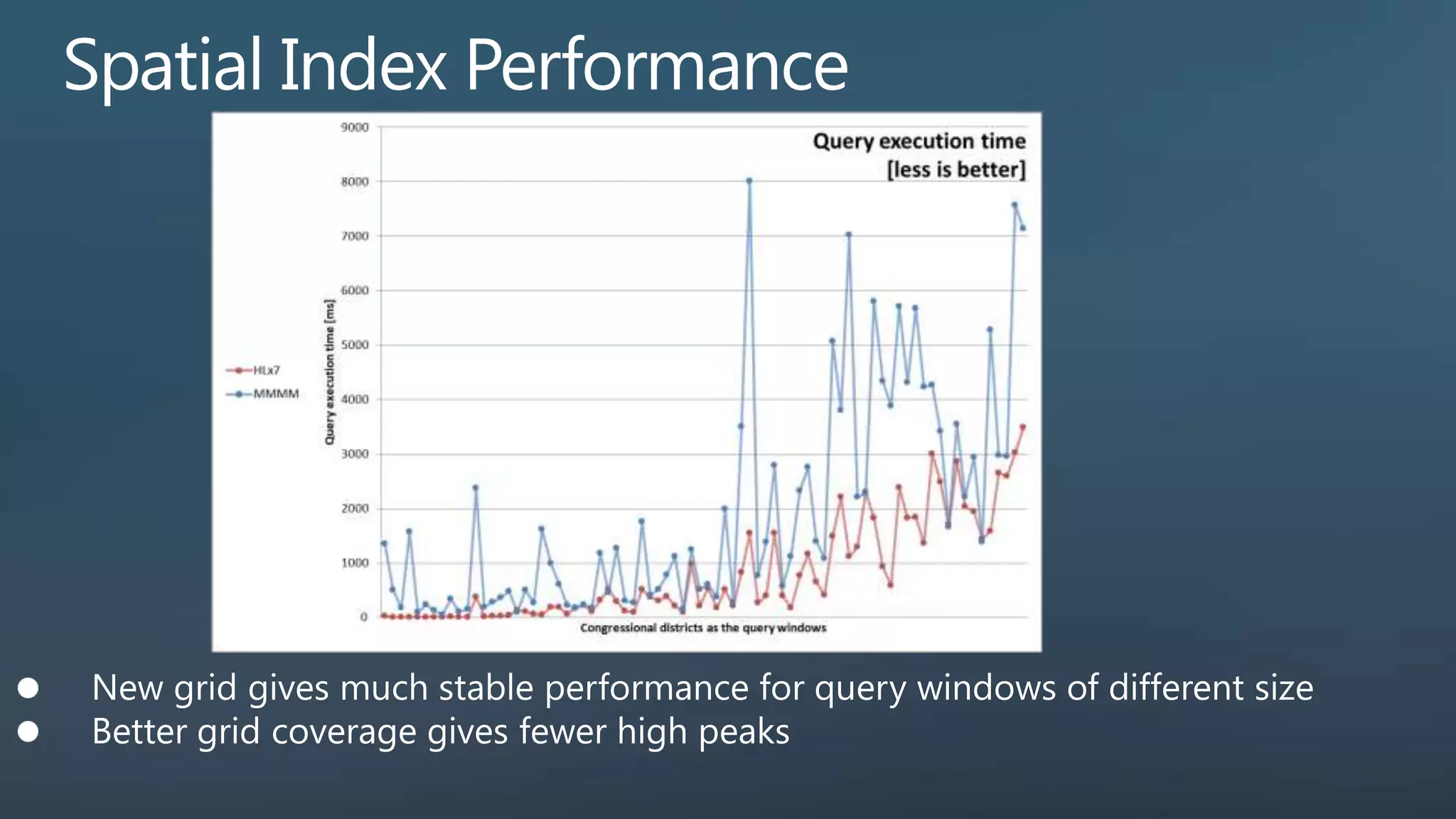
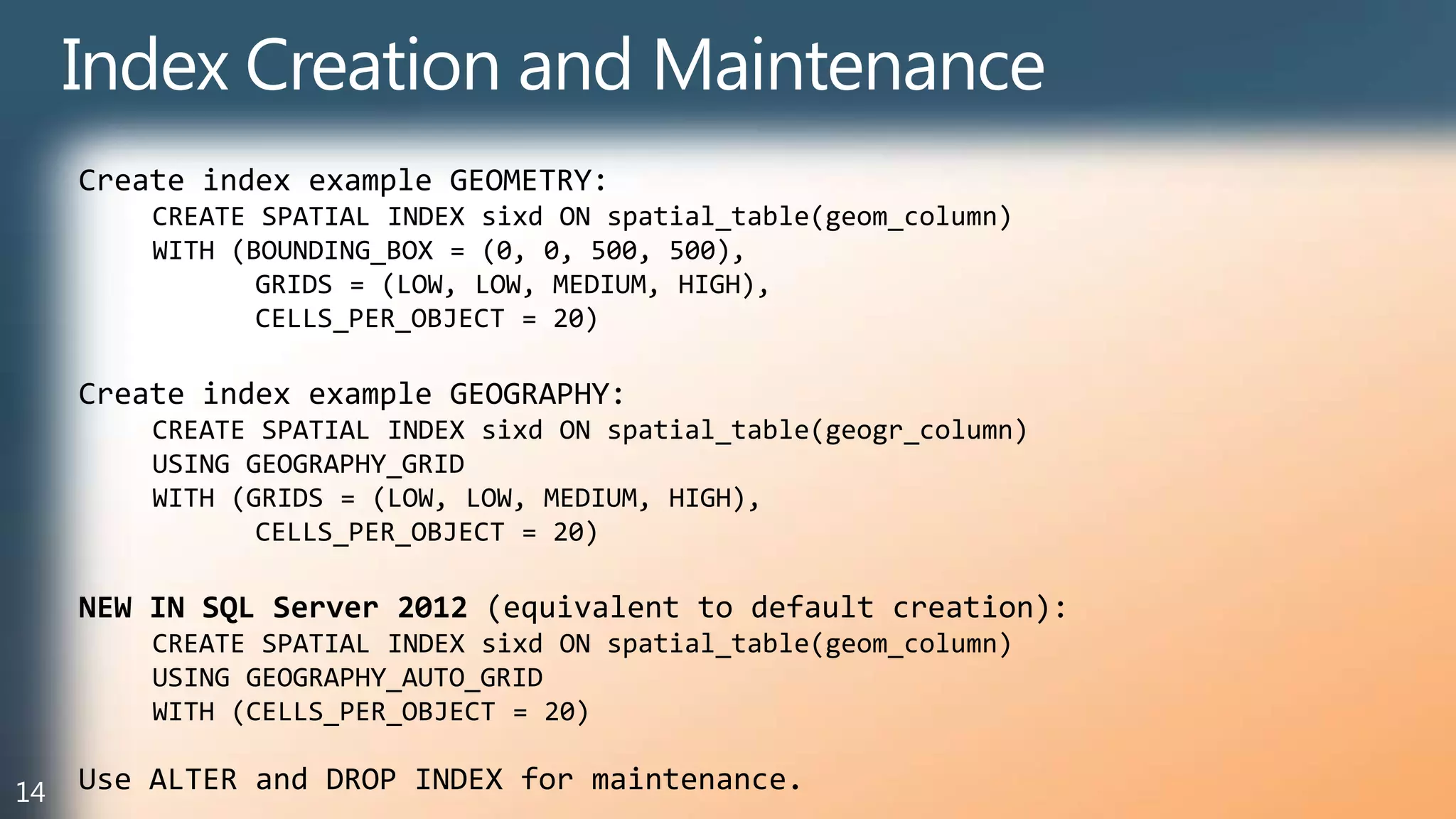

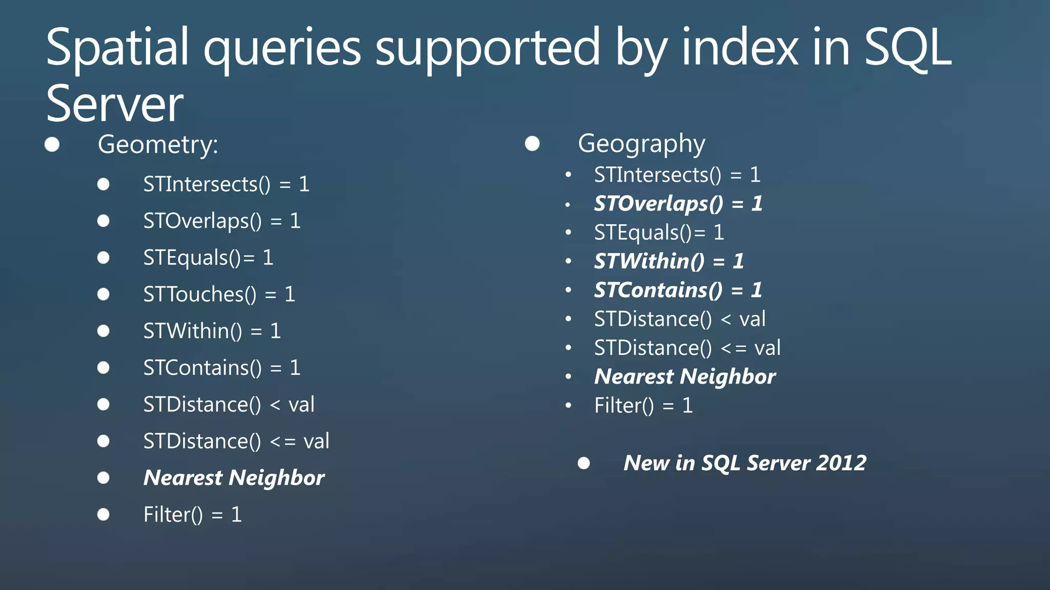
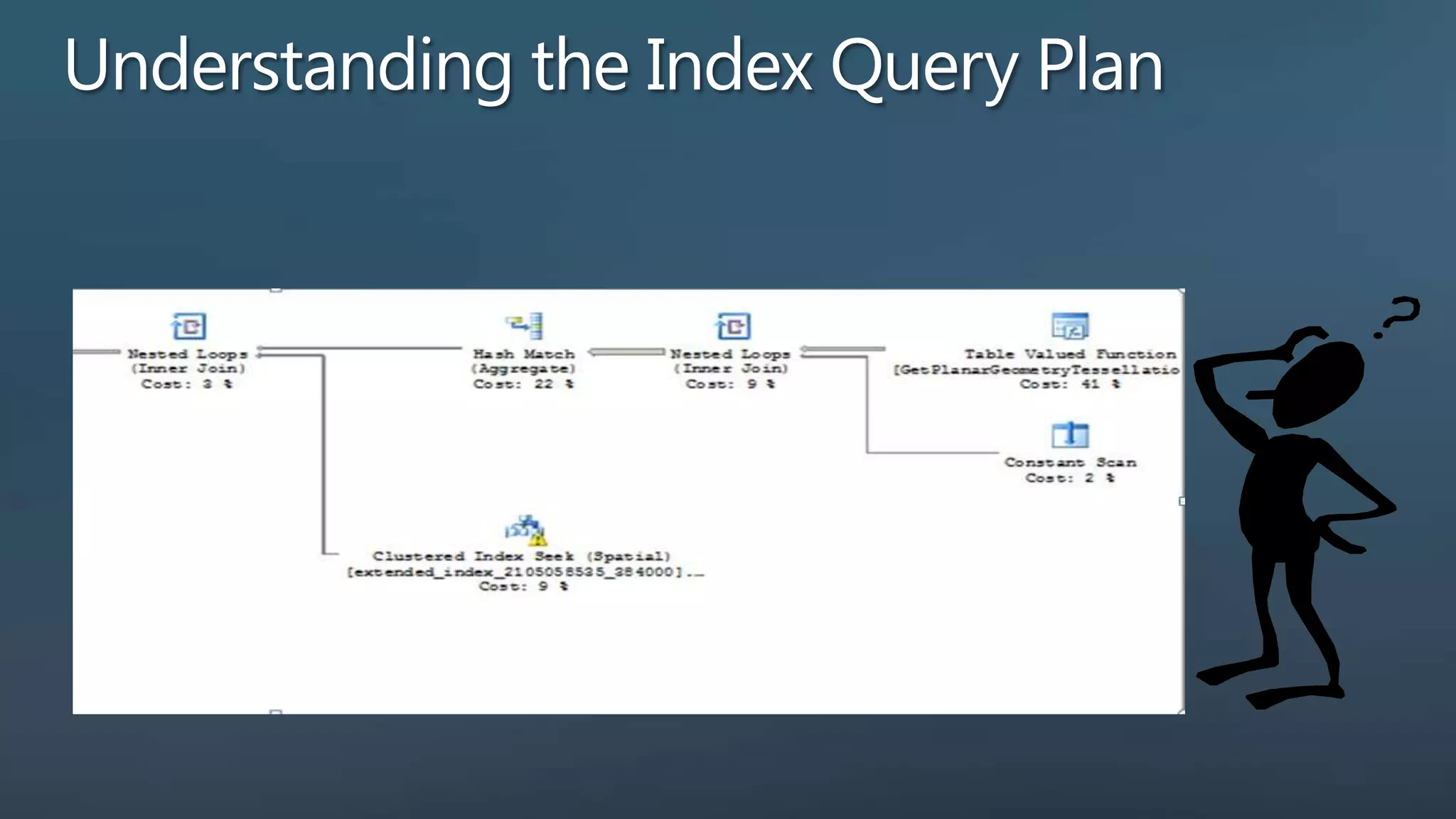
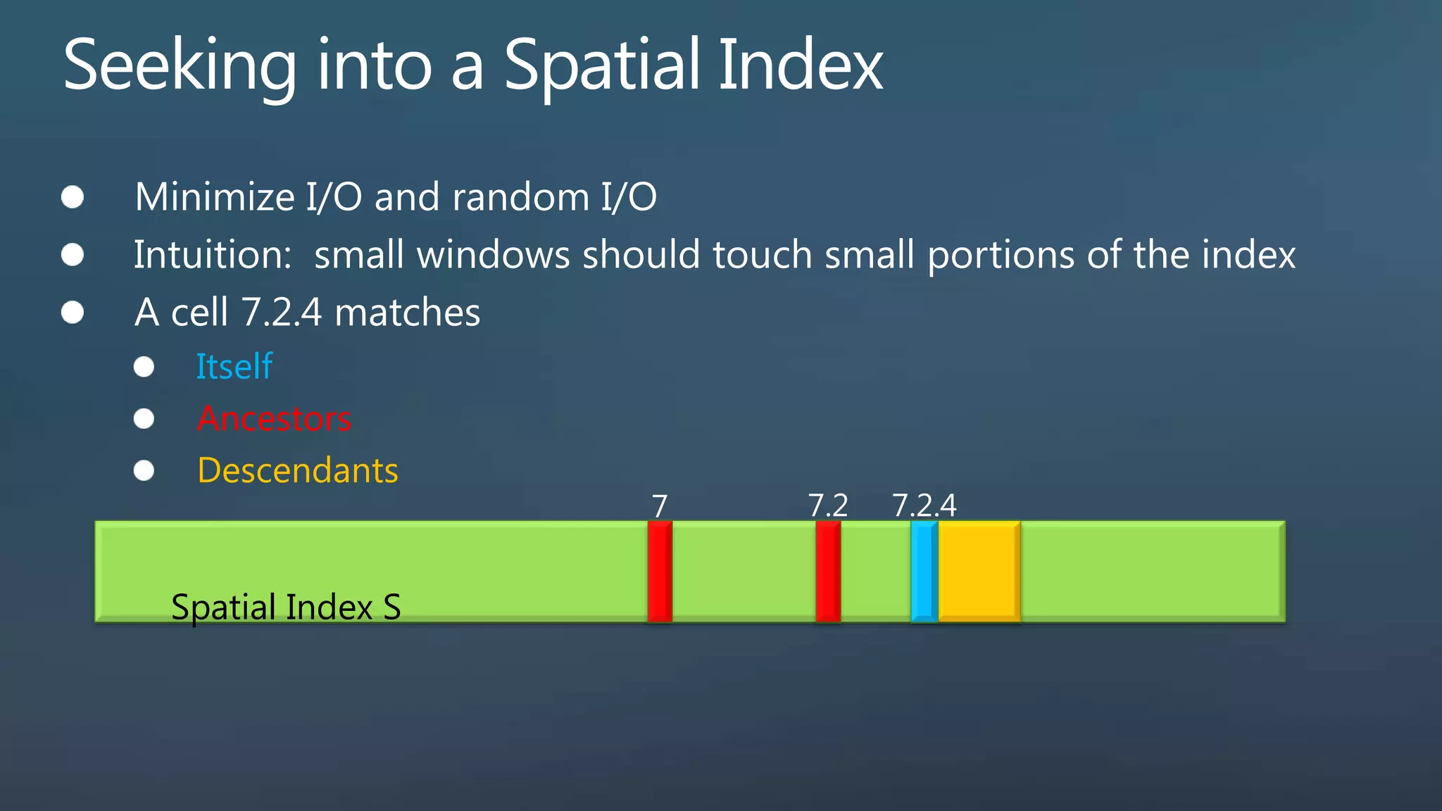
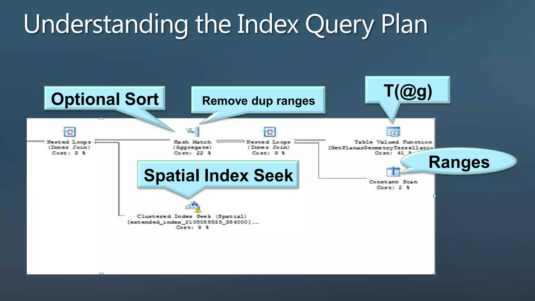
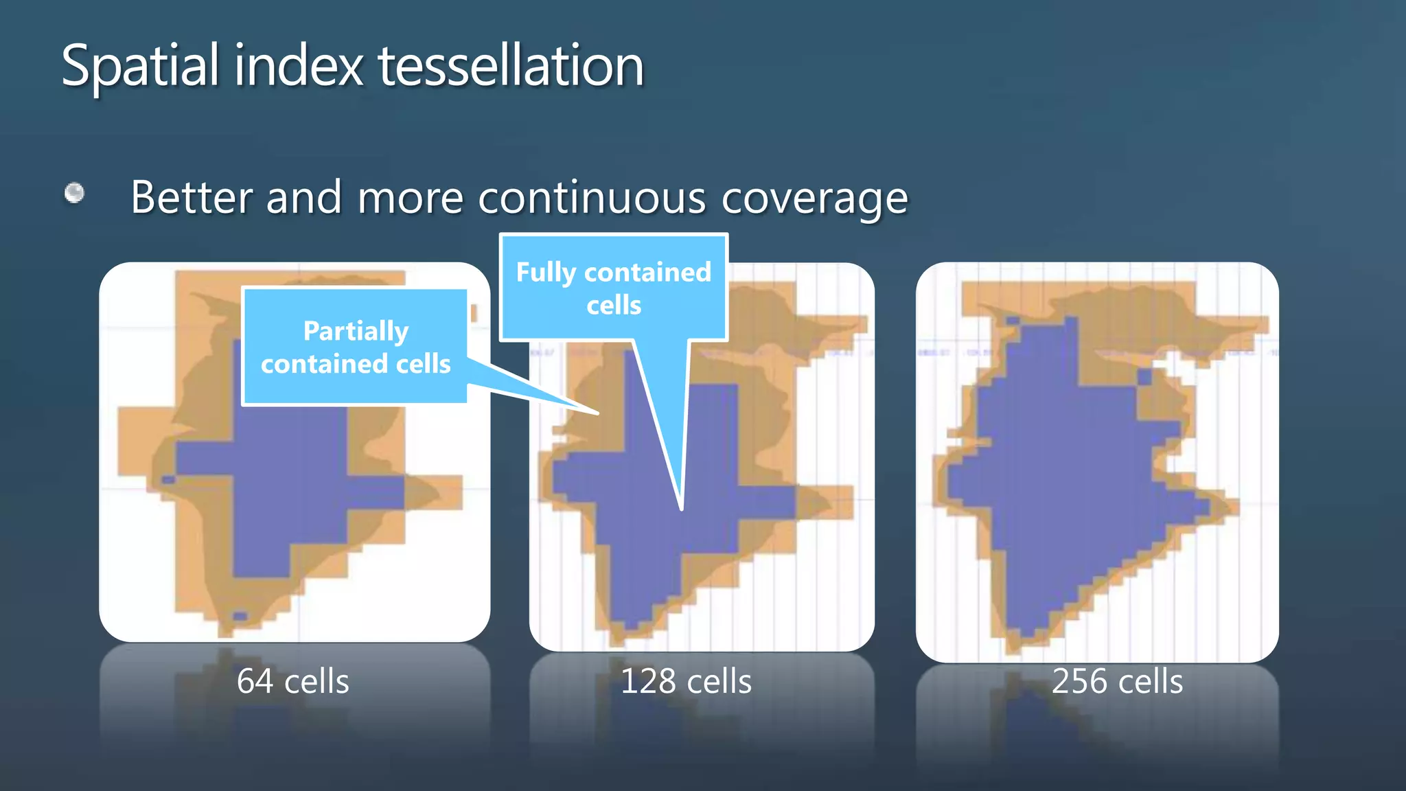
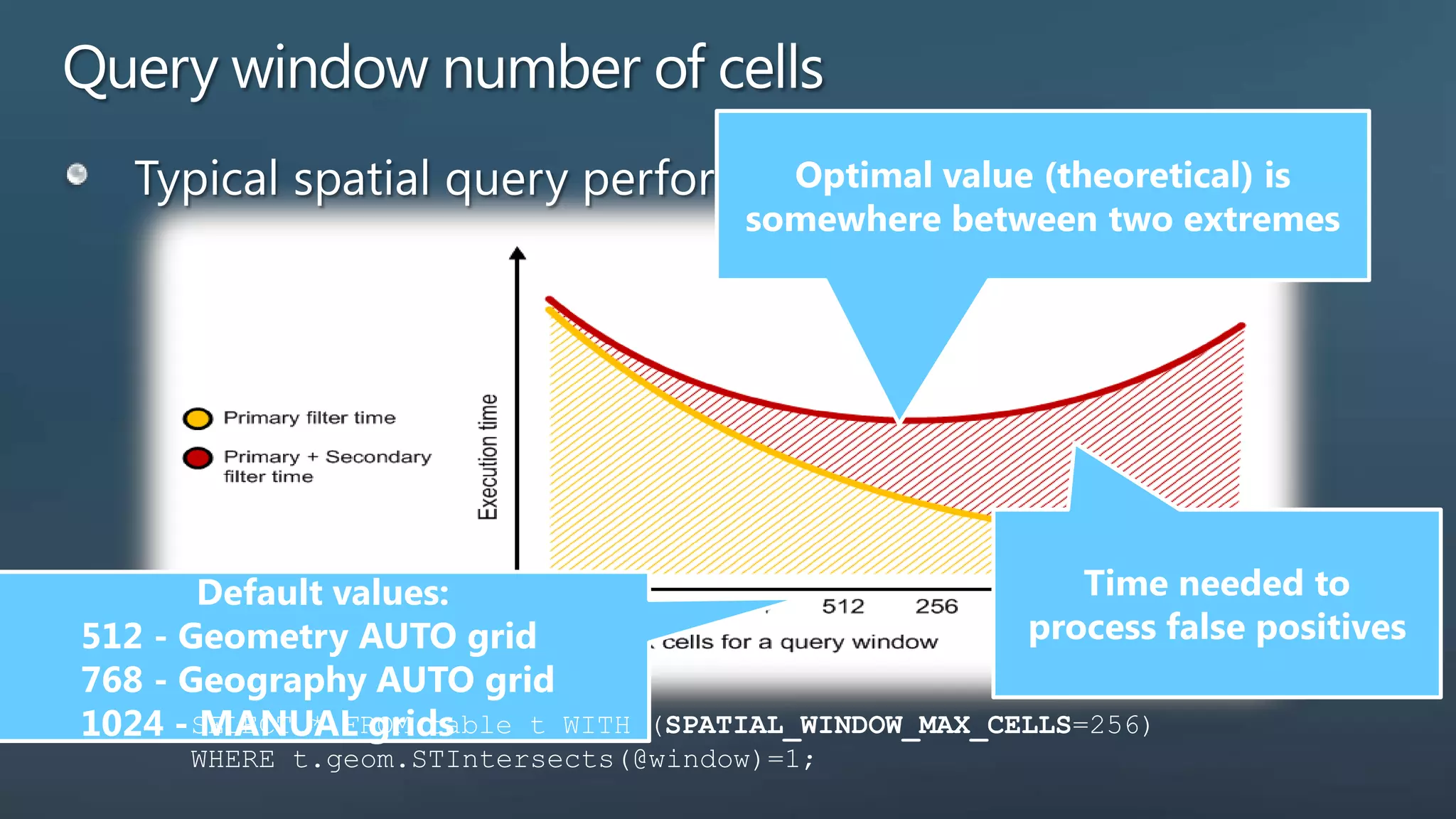

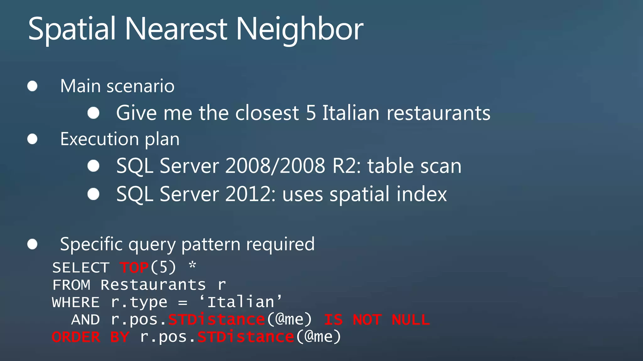
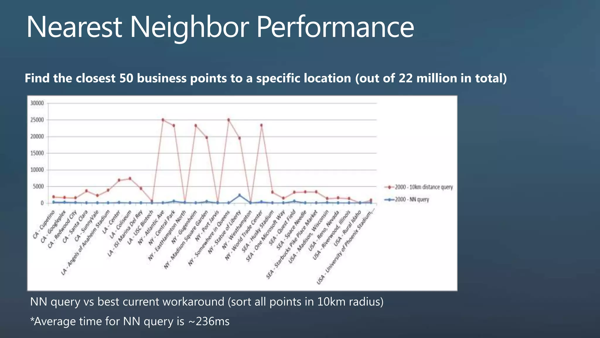
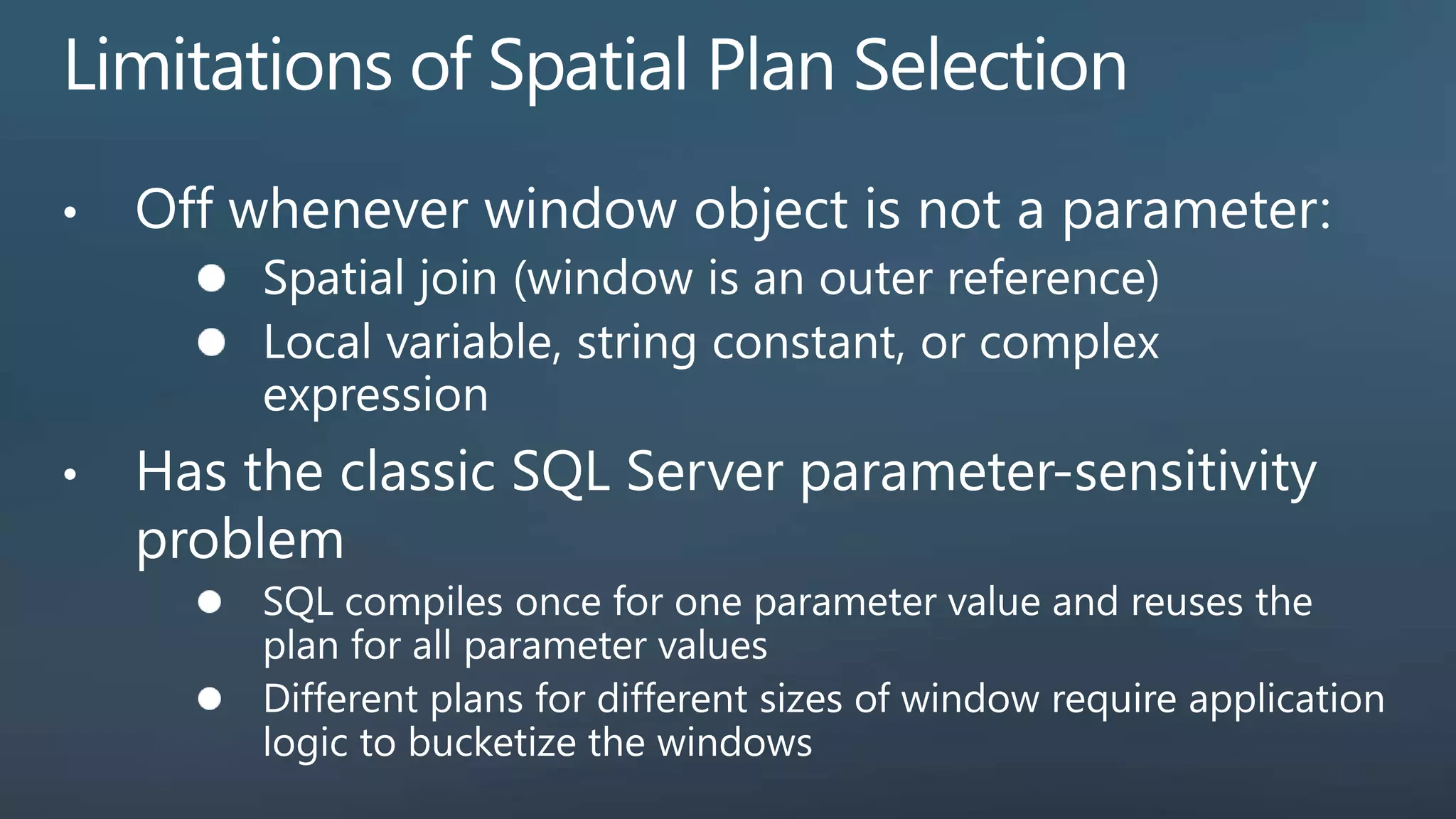
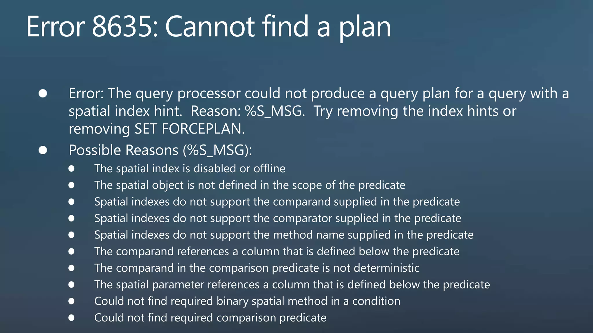
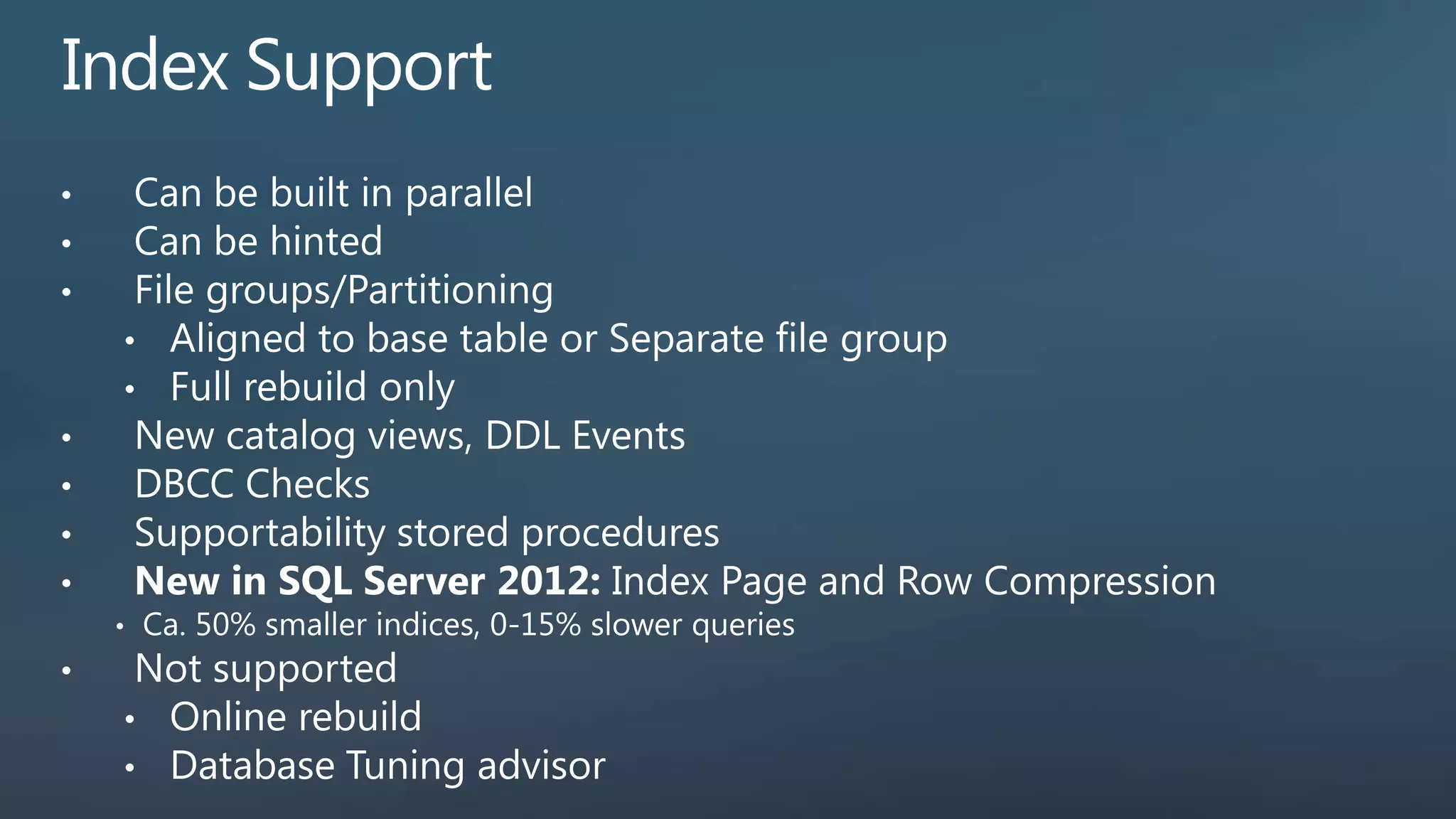
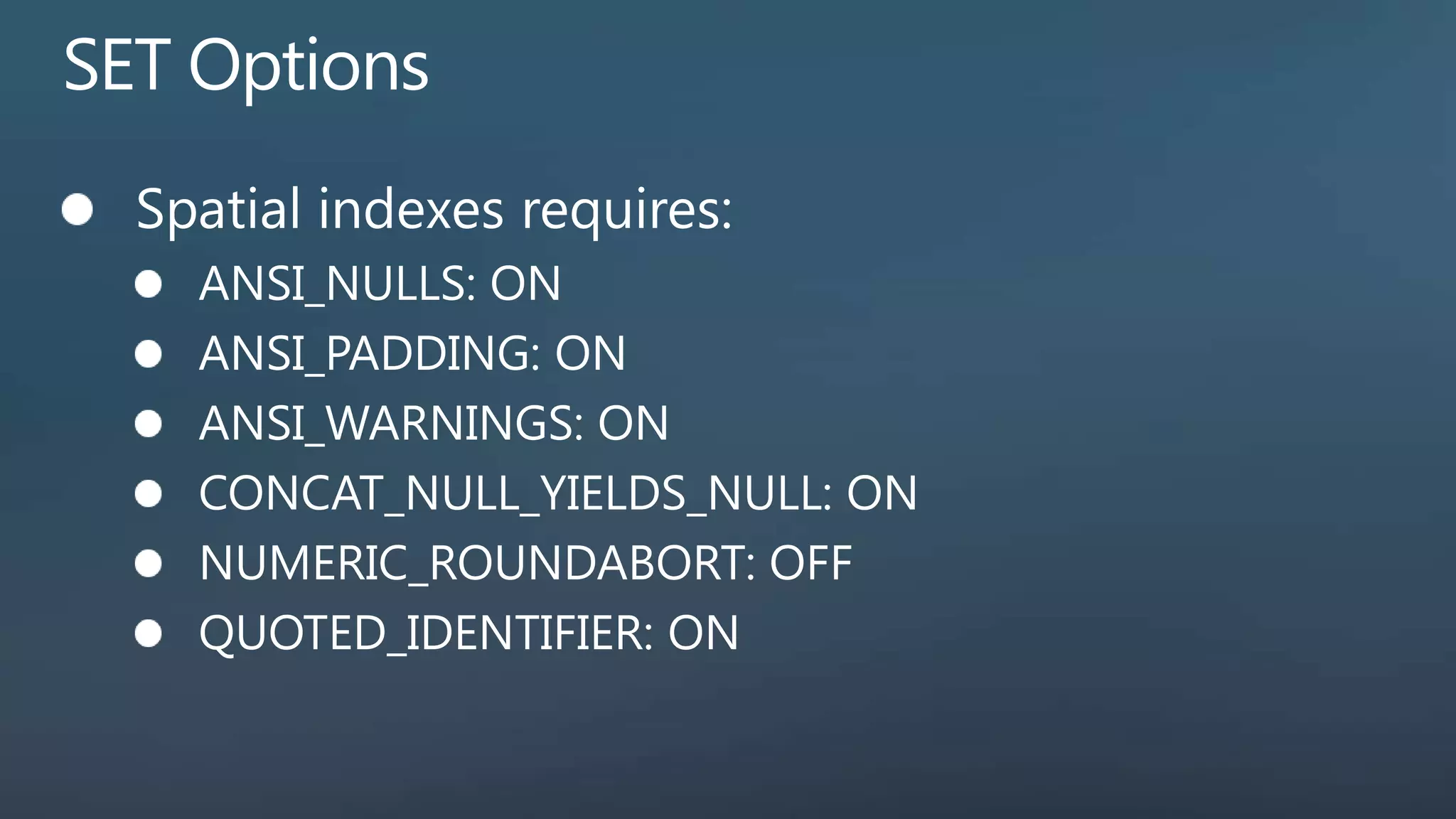
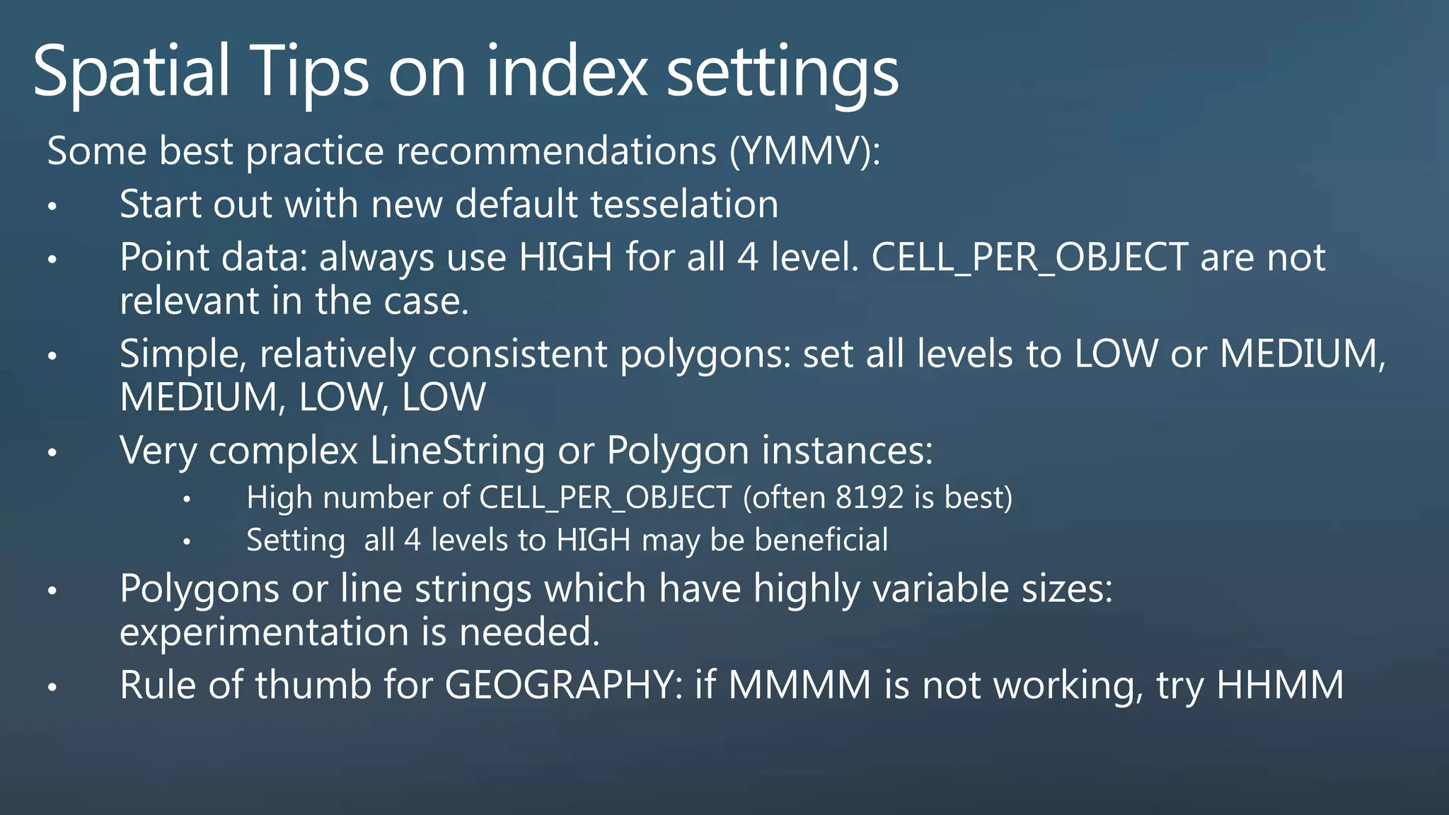
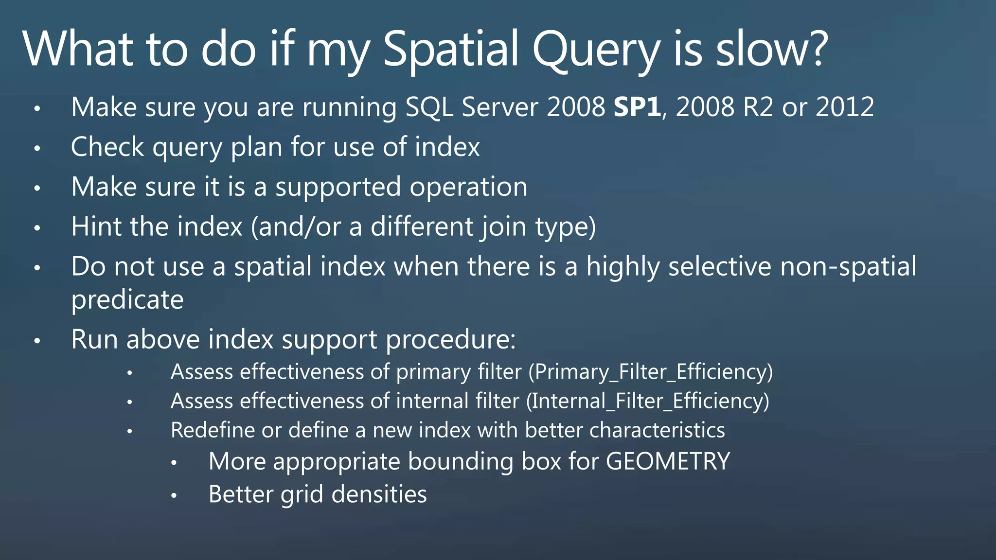
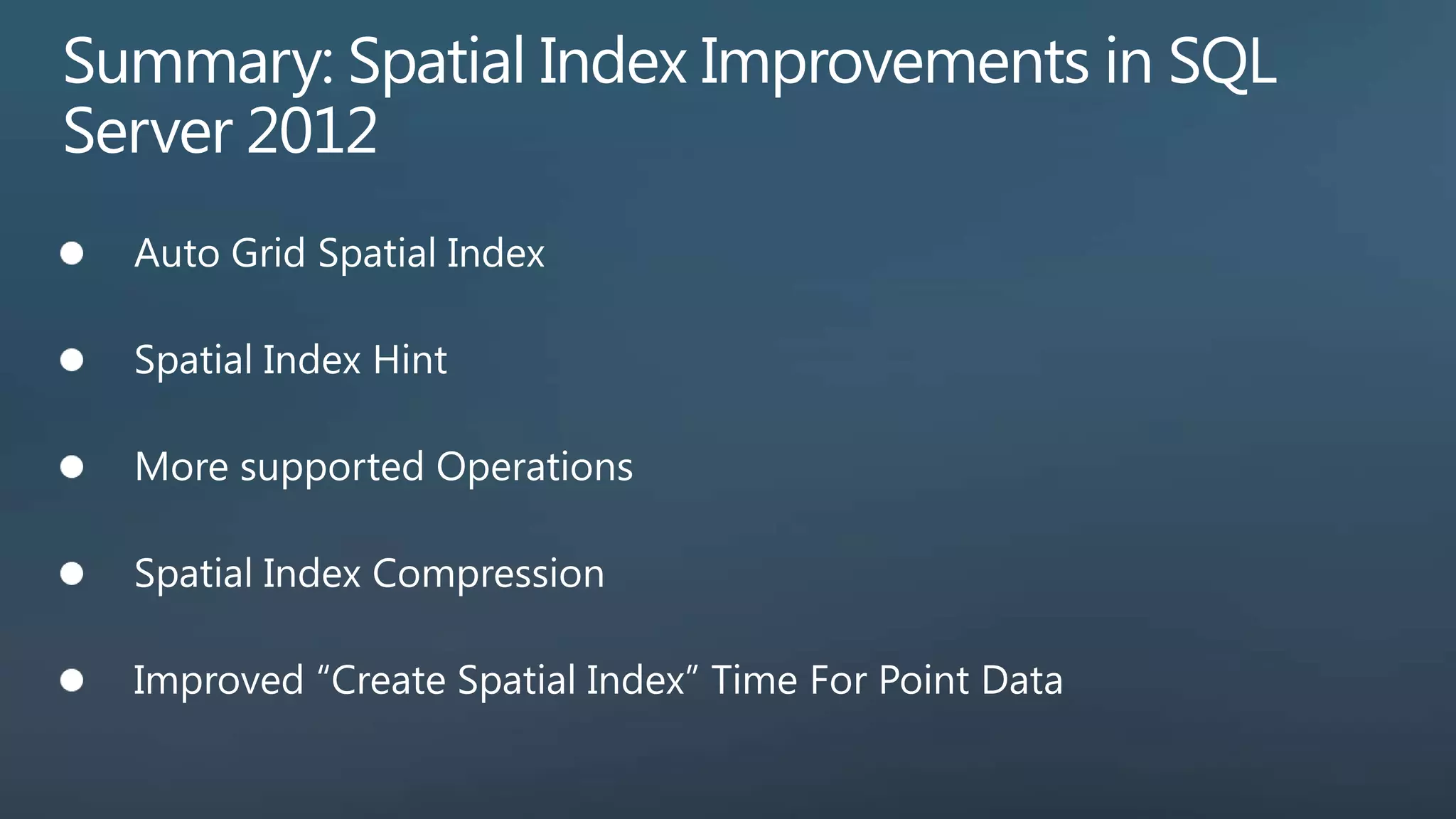

The document details SQL spatial query execution, focusing on the use of spatial indexes and geometry methods like STIntersects for optimizing query performance. It outlines the difference between primary and secondary filtering strategies for handling spatial data, including cardinality estimation and various indexing techniques introduced in SQL Server 2012. Additionally, it provides examples of querying spatial data to find optimized results, such as nearest neighbor searches and spatial index analysis tools.