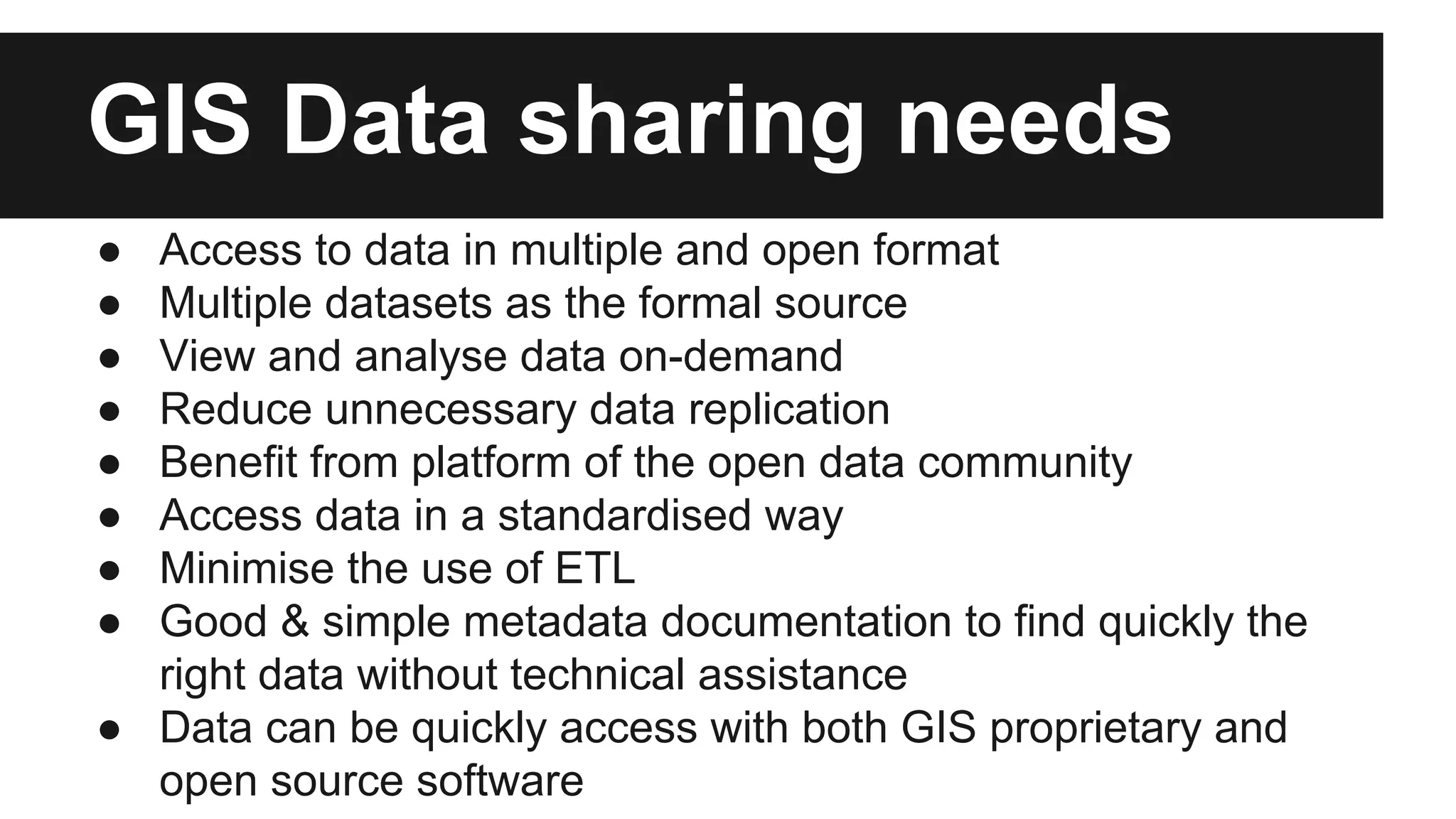
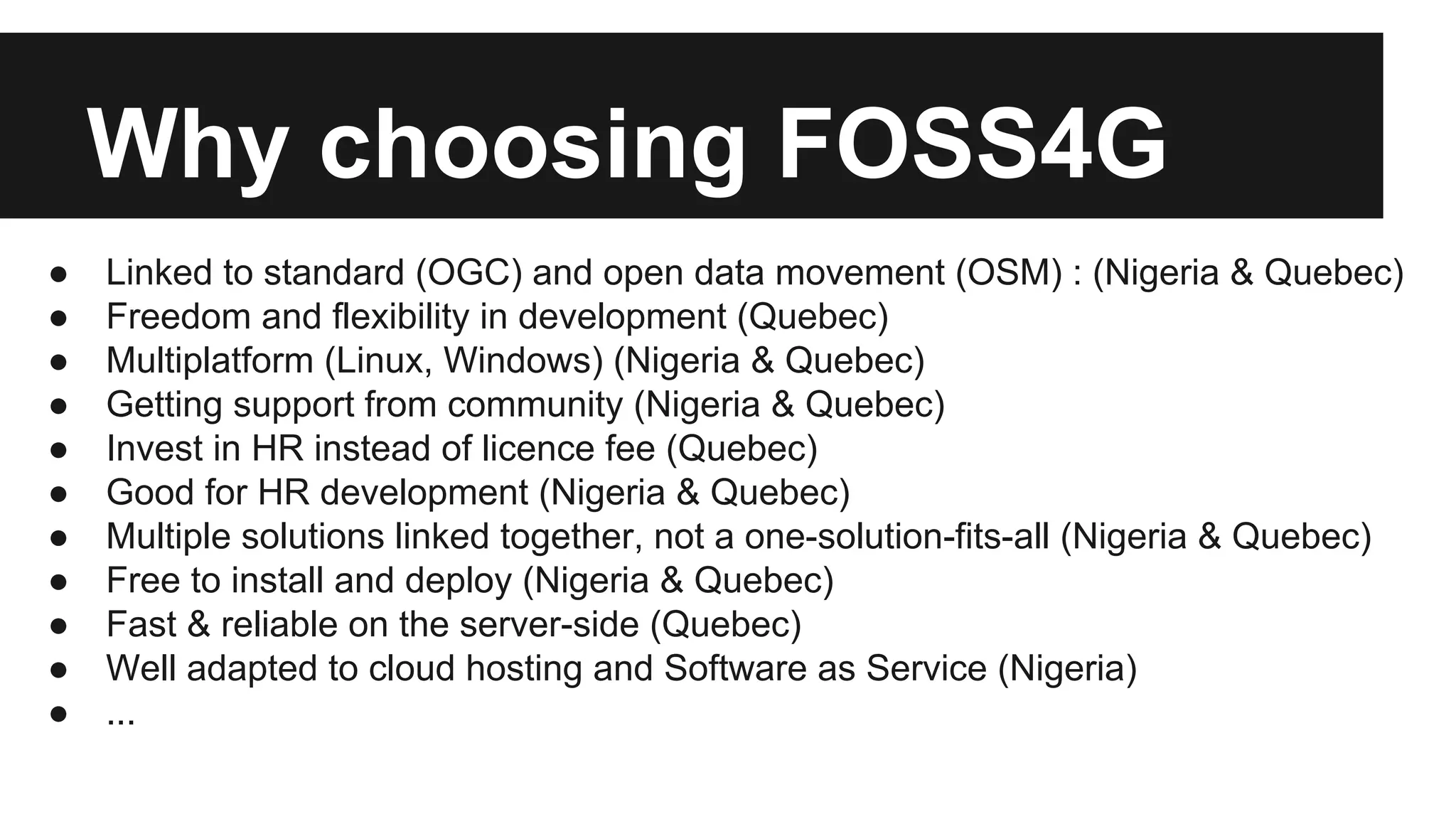
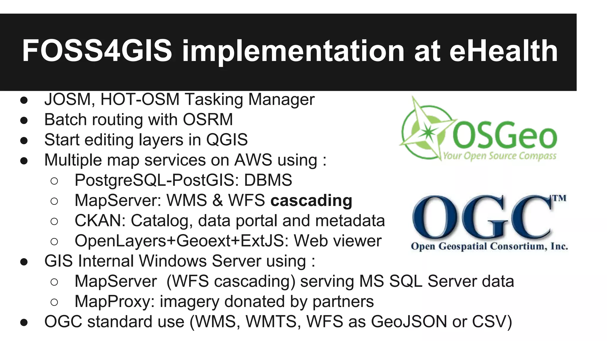
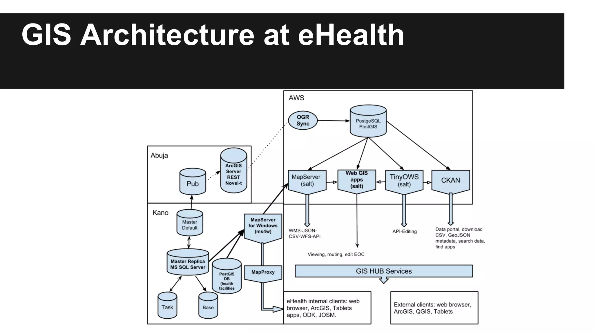
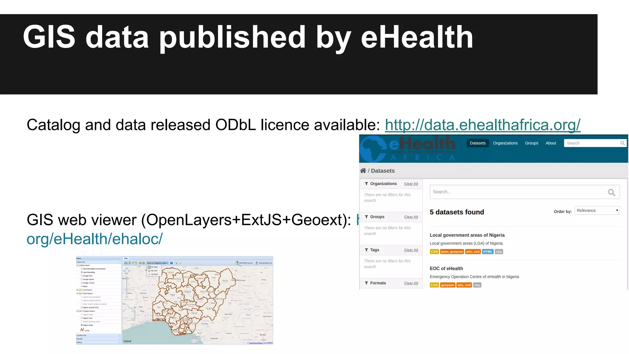
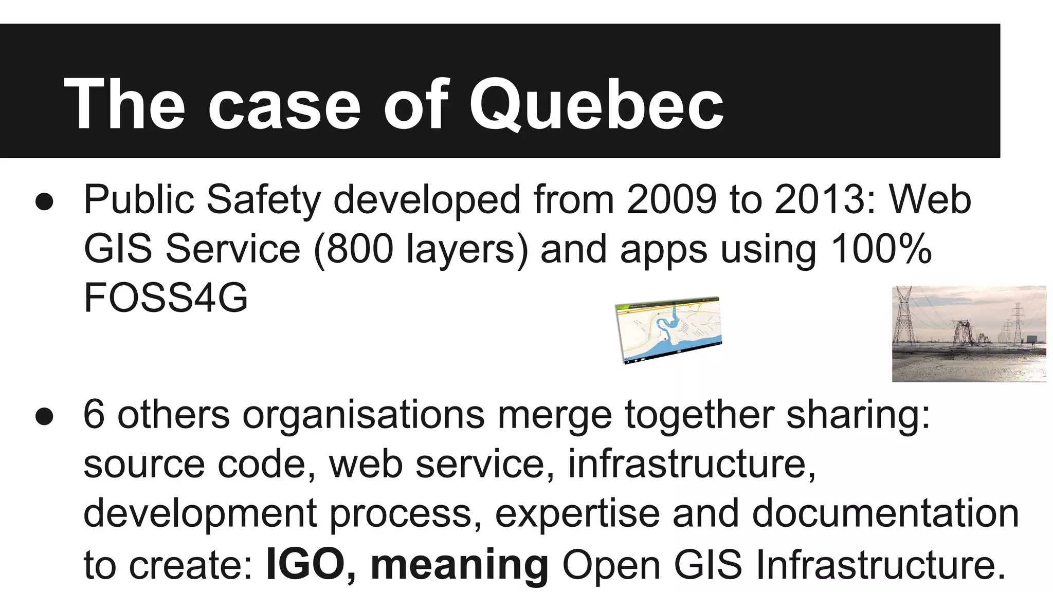
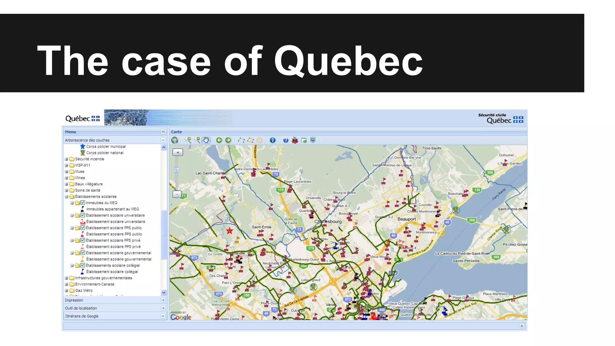
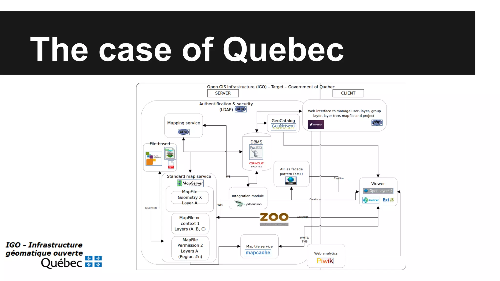
Open Source GIS stack: data Hub for flexibility, performance and effectiveness. Nicolas Gignac, Public Safety Quebec & eHealth Africa Frank Salet, eHealth Africa
Plan ● GIS Data sharing needs ● Why choosing FOSS4G? ● The case of Nigeria ● The case of Quebec in Canada ● Opportunities of partnership
GIS Data sharing needs ● Access to data in multiple and open format ● Multiple datasets as the formal source ● View and analyse data on-demand ● Reduce unnecessary data replication ● Benefit from platform of the open data community ● Access data in a standardised way ● Minimise the use of ETL ● Good & simple metadata documentation to find quickly the right data without technical assistance ● Data can be quickly access with both GIS proprietary and open source software
Why choosing FOSS4G ● Linked to standard (OGC) and open data movement (OSM) : (Nigeria & Quebec) ● Freedom and flexibility in development (Quebec) ● Multiplatform (Linux, Windows) (Nigeria & Quebec) ● Getting support from community (Nigeria & Quebec) ● Invest in HR instead of licence fee (Quebec) ● Good for HR development (Nigeria & Quebec) ● Multiple solutions linked together, not a one-solution-fits-all (Nigeria & Quebec) ● Free to install and deploy (Nigeria & Quebec) ● Fast & reliable on the server-side (Quebec) ● Well adapted to cloud hosting and Software as Service (Nigeria) ● ...
The case of Nigeria ● Use case present earlier at FOSS4G-Asia (Yesterday) ● eHealth Africa : Supporting polio eradication programme since 2011 and Ebola outbreak response ● US NGO using technology to give health service in Northern Nigeria ● NGO is supported by external private funds & support from WHO ● IT Development towards open source (GeoDjango, FormHub, tablet apps) ● GIS is more an hybrid model (ESRI+FOSS4G) ● Hired as GIS International Consultant to help their 20 GIS staffs for a short term project and FOSS4G training
GIS implementation at eHealth ● Support ESRI licences by funding ● ArcGIS-ArcMap used for editing ● Uses MS SQL Server for database and versioning ● Support by OpenStreetMap - Humanitarian Team (HOT) ● FTP transfer from database to Health applications ● Expensive licences and versioning with ESRI complex ● ArcGIS Rest not performant for ETL needs or cascading need ● Stack of open source tools develop for none-GIS apps by IT Team (GeoDjango, PostgreSQL, OpenData kit, FormHub, Salt, nginx)
FOSS4GIS implementation at eHealth ● JOSM, HOT-OSM Tasking Manager ● Batch routing with OSRM ● Start editing layers in QGIS ● Multiple map services on AWS using : ○ PostgreSQL-PostGIS: DBMS ○ MapServer: WMS & WFS cascading ○ CKAN: Catalog, data portal and metadata ○ OpenLayers+Geoext+ExtJS: Web viewer ● GIS Internal Windows Server using : ○ MapServer (WFS cascading) serving MS SQL Server data ○ MapProxy: imagery donated by partners ● OGC standard use (WMS, WMTS, WFS as GeoJSON or CSV)
GIS Architecture at eHealth
GIS data published by eHealth Catalog and data released ODbL licence available: http://data.ehealthafrica.org/ GIS web viewer (OpenLayers+ExtJS+Geoext): http://gis.ehealthafrica. org/eHealth/ehaloc/
The case of Quebec (Canada) ● Need flexible, open, not costly and reliable 24/7 GIS service solutions ● Focus over data on-demand, integration, analysis and publish on the web ● Flow of information and data support decision in disaster management ● Since 2008, Quebec Public Safety used and involved in GIS open source (MapServer, OpenLayers, PostGIS), open data (GeoNetwork) and open standard (WMS, WFS) ● Use standard (OGC member, OASIS) to be interoperable with other GIS system (ESRI, Hexagon- GeoMedia) used by multiple partners (private, public, NGO, citizen)
The case of Quebec ● Public Safety developed from 2009 to 2013: Web GIS Service (800 layers) and apps using 100% FOSS4G ● 6 others organisations merge together sharing: source code, web service, infrastructure, development process, expertise and documentation to create: IGO, meaning Open GIS Infrastructure.
The case of Quebec
The case of Quebec ● IGO has multiple components: ○ Web GIS viewer: XML file config ○ Layer tree Manager and security: XML file & database configuration ○ Editing tools based on WFS-T, but as GeoJSON service ○ Spatial Analysis Service - WFS & WPS with Zoo project ○ Routing Service - OSRM with gov data ○ Metadata Service - GeoNetwork - PostgreSQL ○ Geocoding Service - as PHP Service - SOAP
The case of Quebec ● IGO is an API on top of JavaScript & Phalcon ● IGO has a data security model liked on GeoPrisma ● IGO depends on UMN MapServer, but can act as a WMS client ● XML config on top of OpenLayers two, GeoExt 1.0 ● Adapted to change backend libraries (OL3, Leaflet) without XML change ● Made also for integration in web site/portal as iframe ● IGO is an API based on MVC (Model-View-Controller) ● Planned to be open source in 2015 as LGPL licence
The case of Quebec IT Environment : ● Ubuntu 14.04 LTS, CentOS ● Security : LemonLDAP & Apache ● DBMS: PostgreSQLPostGIS, Oracle ● FOSS4G : MapServer, OpenLayers, MapCache, PHP (Phalcon), GeoExt, ExtJs, JQuery, OSRM, Zoo project ● Standard: WMS, WFS, CSW, WMTS, WPS, SOAP and CAP ● Cascading: WMS & WFS of partners services (close to the source) ● GDAL/OGR (ETL) ● Gitlab & Redmine (forge)
The case of Quebec
The case of Quebec IGO Governance (based on UMN MapServer Community) : ● 7 Ministries main contributors ● 15 organisations as users ● Other potential organisation 4 levels of partners: - Contributors - Committers - Technical committee - Management committee
Possible partnerships eHealth: public health, mobile technology, OSM data, Software as a service, cloud deployment mapping@eHealthAfrica.org Quebec Public Safety: involve in IGO when code release, disaster management, FOSS4G, web standard, web spatial analysis, community-based development for government/municipality organisation geomsp@msp.gouv.qc.ca
Contact Email: gignacnic@gmail.com Slideshare: ehealthAfrica Linkedin: http://ca.linkedin.com/pub/nicolas-gignac/20/690/a42/
Press release ● eHealth Africa: http://ehealthafrica.org and http://ehealthafrica. org/open-street-map-and-ehealth-gis-projects/ ● Slashgeo.org: http://slashgeo.org/ ● http://www.irinnews.org/report/98127/analysis-which-technology-to-use-for-disaster- management ○ http://www.directionsmag.com/articles/open-source-software-and-ogc-web- services-life-saving-components-in-qu/217989

Open Source GIS Stack: Data hub for flexibility, performance and effectiveness

  • 1.
    Open Source GISstack: data Hub for flexibility, performance and effectiveness. Nicolas Gignac, Public Safety Quebec & eHealth Africa Frank Salet, eHealth Africa
  • 2.
    Plan ● GISData sharing needs ● Why choosing FOSS4G? ● The case of Nigeria ● The case of Quebec in Canada ● Opportunities of partnership
  • 3.
    GIS Data sharingneeds ● Access to data in multiple and open format ● Multiple datasets as the formal source ● View and analyse data on-demand ● Reduce unnecessary data replication ● Benefit from platform of the open data community ● Access data in a standardised way ● Minimise the use of ETL ● Good & simple metadata documentation to find quickly the right data without technical assistance ● Data can be quickly access with both GIS proprietary and open source software
  • 4.
    Why choosing FOSS4G ● Linked to standard (OGC) and open data movement (OSM) : (Nigeria & Quebec) ● Freedom and flexibility in development (Quebec) ● Multiplatform (Linux, Windows) (Nigeria & Quebec) ● Getting support from community (Nigeria & Quebec) ● Invest in HR instead of licence fee (Quebec) ● Good for HR development (Nigeria & Quebec) ● Multiple solutions linked together, not a one-solution-fits-all (Nigeria & Quebec) ● Free to install and deploy (Nigeria & Quebec) ● Fast & reliable on the server-side (Quebec) ● Well adapted to cloud hosting and Software as Service (Nigeria) ● ...
  • 5.
    The case ofNigeria ● Use case present earlier at FOSS4G-Asia (Yesterday) ● eHealth Africa : Supporting polio eradication programme since 2011 and Ebola outbreak response ● US NGO using technology to give health service in Northern Nigeria ● NGO is supported by external private funds & support from WHO ● IT Development towards open source (GeoDjango, FormHub, tablet apps) ● GIS is more an hybrid model (ESRI+FOSS4G) ● Hired as GIS International Consultant to help their 20 GIS staffs for a short term project and FOSS4G training
  • 6.
    GIS implementation ateHealth ● Support ESRI licences by funding ● ArcGIS-ArcMap used for editing ● Uses MS SQL Server for database and versioning ● Support by OpenStreetMap - Humanitarian Team (HOT) ● FTP transfer from database to Health applications ● Expensive licences and versioning with ESRI complex ● ArcGIS Rest not performant for ETL needs or cascading need ● Stack of open source tools develop for none-GIS apps by IT Team (GeoDjango, PostgreSQL, OpenData kit, FormHub, Salt, nginx)
  • 7.
    FOSS4GIS implementation ateHealth ● JOSM, HOT-OSM Tasking Manager ● Batch routing with OSRM ● Start editing layers in QGIS ● Multiple map services on AWS using : ○ PostgreSQL-PostGIS: DBMS ○ MapServer: WMS & WFS cascading ○ CKAN: Catalog, data portal and metadata ○ OpenLayers+Geoext+ExtJS: Web viewer ● GIS Internal Windows Server using : ○ MapServer (WFS cascading) serving MS SQL Server data ○ MapProxy: imagery donated by partners ● OGC standard use (WMS, WMTS, WFS as GeoJSON or CSV)
  • 8.
  • 9.
    GIS data publishedby eHealth Catalog and data released ODbL licence available: http://data.ehealthafrica.org/ GIS web viewer (OpenLayers+ExtJS+Geoext): http://gis.ehealthafrica. org/eHealth/ehaloc/
  • 10.
    The case ofQuebec (Canada) ● Need flexible, open, not costly and reliable 24/7 GIS service solutions ● Focus over data on-demand, integration, analysis and publish on the web ● Flow of information and data support decision in disaster management ● Since 2008, Quebec Public Safety used and involved in GIS open source (MapServer, OpenLayers, PostGIS), open data (GeoNetwork) and open standard (WMS, WFS) ● Use standard (OGC member, OASIS) to be interoperable with other GIS system (ESRI, Hexagon- GeoMedia) used by multiple partners (private, public, NGO, citizen)
  • 11.
    The case ofQuebec ● Public Safety developed from 2009 to 2013: Web GIS Service (800 layers) and apps using 100% FOSS4G ● 6 others organisations merge together sharing: source code, web service, infrastructure, development process, expertise and documentation to create: IGO, meaning Open GIS Infrastructure.
  • 12.
  • 13.
    The case ofQuebec ● IGO has multiple components: ○ Web GIS viewer: XML file config ○ Layer tree Manager and security: XML file & database configuration ○ Editing tools based on WFS-T, but as GeoJSON service ○ Spatial Analysis Service - WFS & WPS with Zoo project ○ Routing Service - OSRM with gov data ○ Metadata Service - GeoNetwork - PostgreSQL ○ Geocoding Service - as PHP Service - SOAP
  • 14.
    The case ofQuebec ● IGO is an API on top of JavaScript & Phalcon ● IGO has a data security model liked on GeoPrisma ● IGO depends on UMN MapServer, but can act as a WMS client ● XML config on top of OpenLayers two, GeoExt 1.0 ● Adapted to change backend libraries (OL3, Leaflet) without XML change ● Made also for integration in web site/portal as iframe ● IGO is an API based on MVC (Model-View-Controller) ● Planned to be open source in 2015 as LGPL licence
  • 15.
    The case ofQuebec IT Environment : ● Ubuntu 14.04 LTS, CentOS ● Security : LemonLDAP & Apache ● DBMS: PostgreSQLPostGIS, Oracle ● FOSS4G : MapServer, OpenLayers, MapCache, PHP (Phalcon), GeoExt, ExtJs, JQuery, OSRM, Zoo project ● Standard: WMS, WFS, CSW, WMTS, WPS, SOAP and CAP ● Cascading: WMS & WFS of partners services (close to the source) ● GDAL/OGR (ETL) ● Gitlab & Redmine (forge)
  • 16.
  • 17.
    The case ofQuebec IGO Governance (based on UMN MapServer Community) : ● 7 Ministries main contributors ● 15 organisations as users ● Other potential organisation 4 levels of partners: - Contributors - Committers - Technical committee - Management committee
  • 18.
    Possible partnerships eHealth:public health, mobile technology, OSM data, Software as a service, cloud deployment mapping@eHealthAfrica.org Quebec Public Safety: involve in IGO when code release, disaster management, FOSS4G, web standard, web spatial analysis, community-based development for government/municipality organisation geomsp@msp.gouv.qc.ca
  • 19.
    Contact Email: gignacnic@gmail.com Slideshare: ehealthAfrica Linkedin: http://ca.linkedin.com/pub/nicolas-gignac/20/690/a42/
  • 20.
    Press release ●eHealth Africa: http://ehealthafrica.org and http://ehealthafrica. org/open-street-map-and-ehealth-gis-projects/ ● Slashgeo.org: http://slashgeo.org/ ● http://www.irinnews.org/report/98127/analysis-which-technology-to-use-for-disaster- management ○ http://www.directionsmag.com/articles/open-source-software-and-ogc-web- services-life-saving-components-in-qu/217989