Landslide monitoring using wireless sensor network
This document summarizes a proposed landslide monitoring system using a wireless sensor network. It discusses how sensor nodes would collect data on factors like slope movement and moisture levels, forward it to a gateway, and ultimately to a field management center. An example is given of how such a system could monitor railway lines in mountainous areas. The current disadvantages of high cost, limited range, and slow data transmission are identified. An improved design is proposed using Zigbee modules for their low cost, high data rates, and ability to communicate over a broader range. The conclusion states the goal is to optimize the system to reduce costs and energy use while extending the lifetime of the wireless sensor network.
ID Name EmailPhone Mahmudul Hasan SL ID Name Email Attendance 1 Mahmudul Hasan present 2 Motiur present 3 Nahifa Binte Ahammed present 4 Sumaiya Ismail present 5 Razia Shultana Priya present Submitted By: Group Name: Decoders Group Members: Group Leader Name:
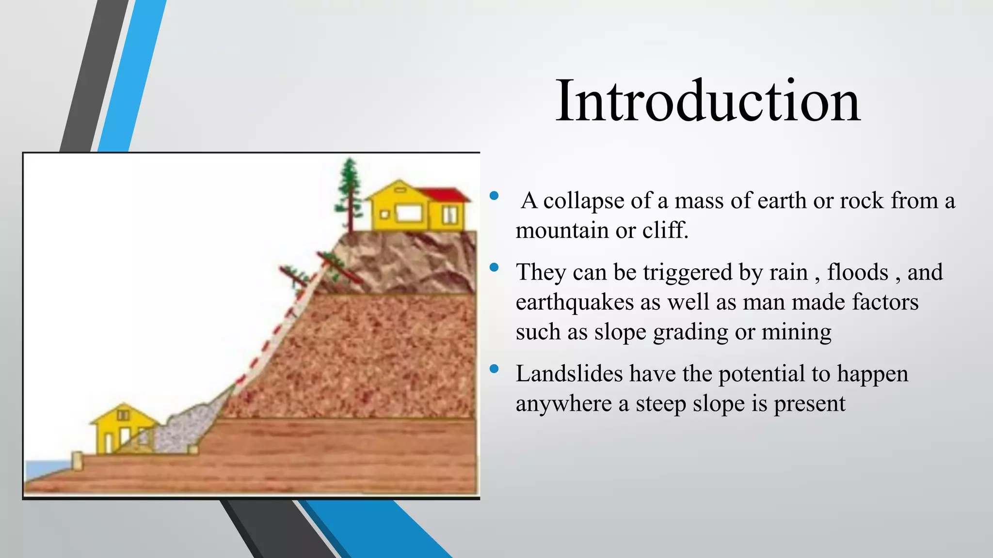
Introduction • A collapseof a mass of earth or rock from a mountain or cliff. • They can be triggered by rain , floods , and earthquakes as well as man made factors such as slope grading or mining • Landslides have the potential to happen anywhere a steep slope is present
5.
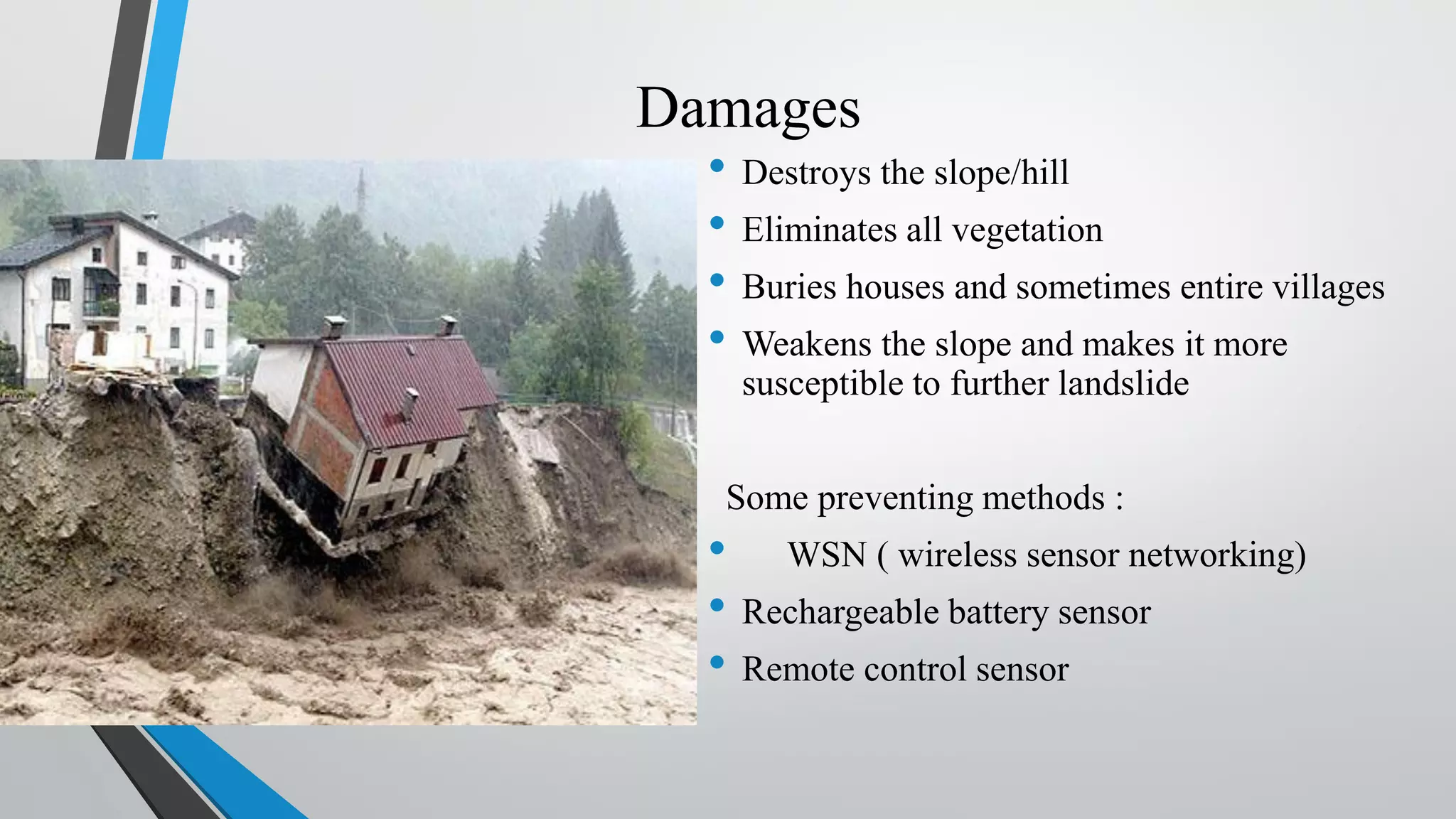
Damages • Destroys theslope/hill • Eliminates all vegetation • Buries houses and sometimes entire villages • Weakens the slope and makes it more susceptible to further landslide Some preventing methods : • WSN ( wireless sensor networking) • Rechargeable battery sensor • Remote control sensor
6.
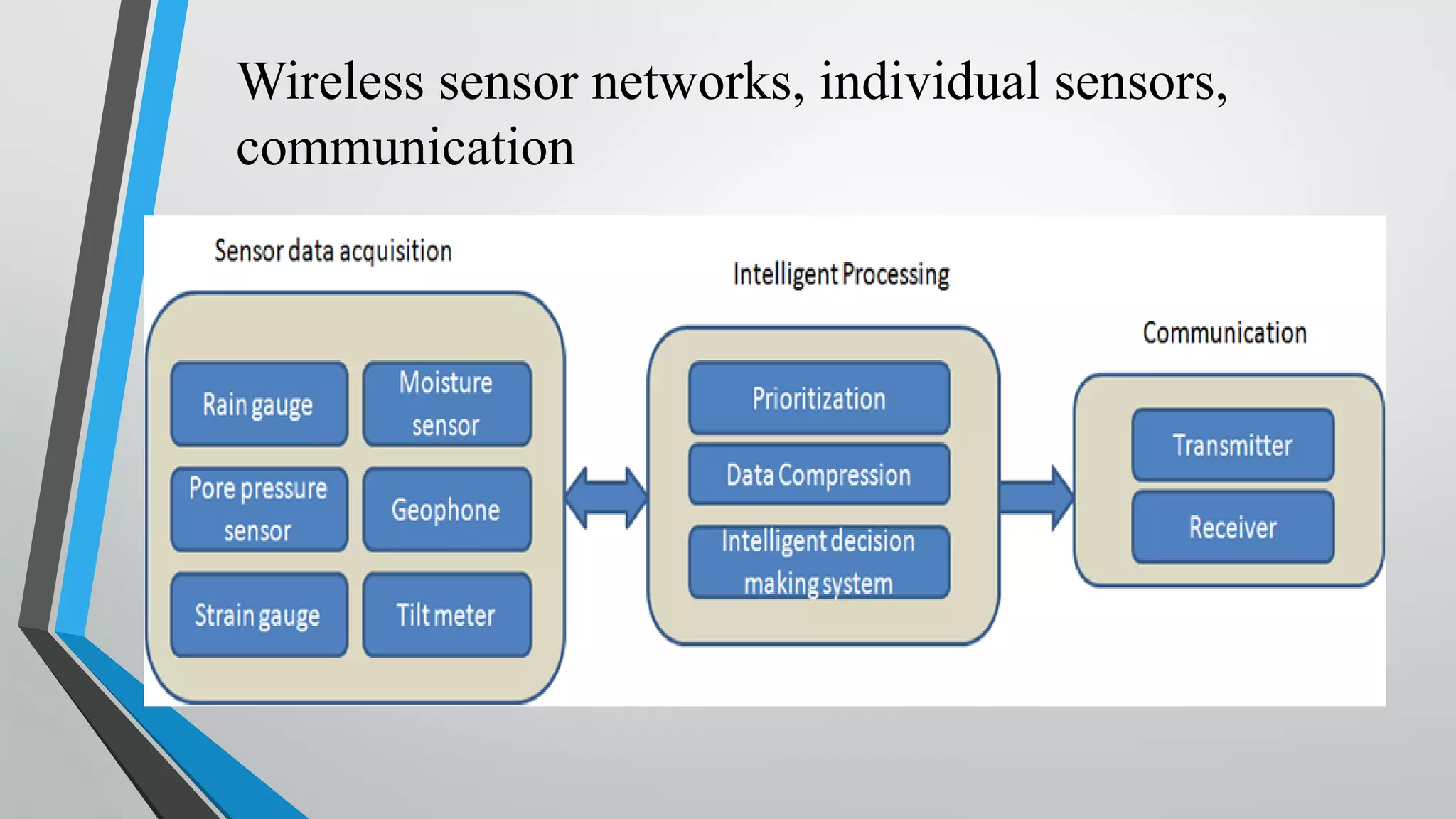
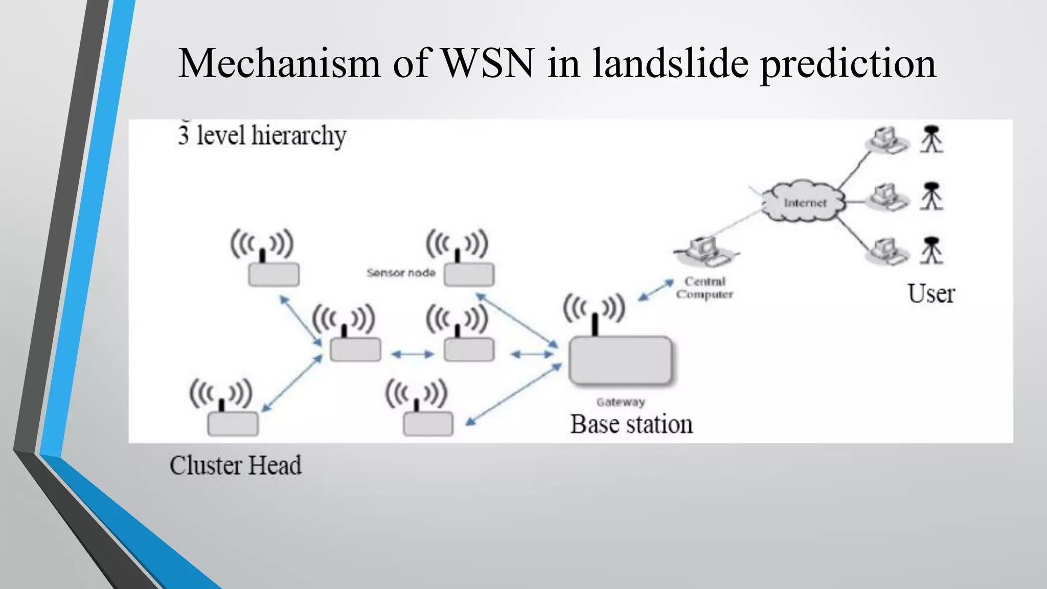
Landslides prediction byWSN • Data retrieved using spatially distributed WSN. • Wireless sensor nodes forward data on to a gateway. • Gateway sends data via a directional wi-fi link to a field data management center (FMC). • Finally collected at a data management center through a satellite link 252km away from the deployment field.
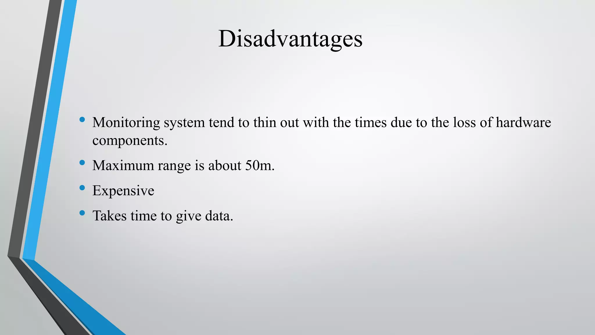
Disadvantages • Monitoring systemtend to thin out with the times due to the loss of hardware components. • Maximum range is about 50m. • Expensive • Takes time to give data.
11.
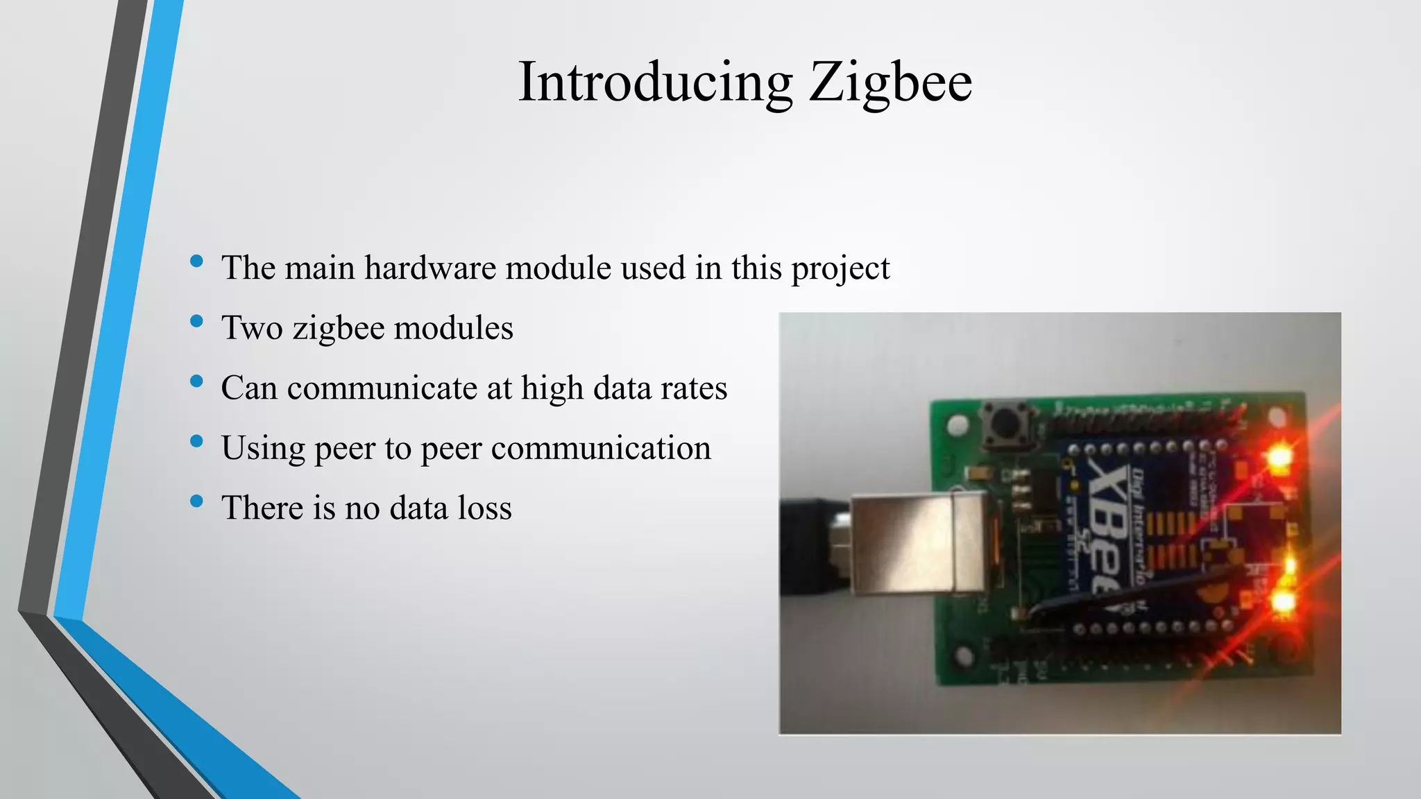
Introducing Zigbee • Themain hardware module used in this project • Two zigbee modules • Can communicate at high data rates • Using peer to peer communication • There is no data loss
12.
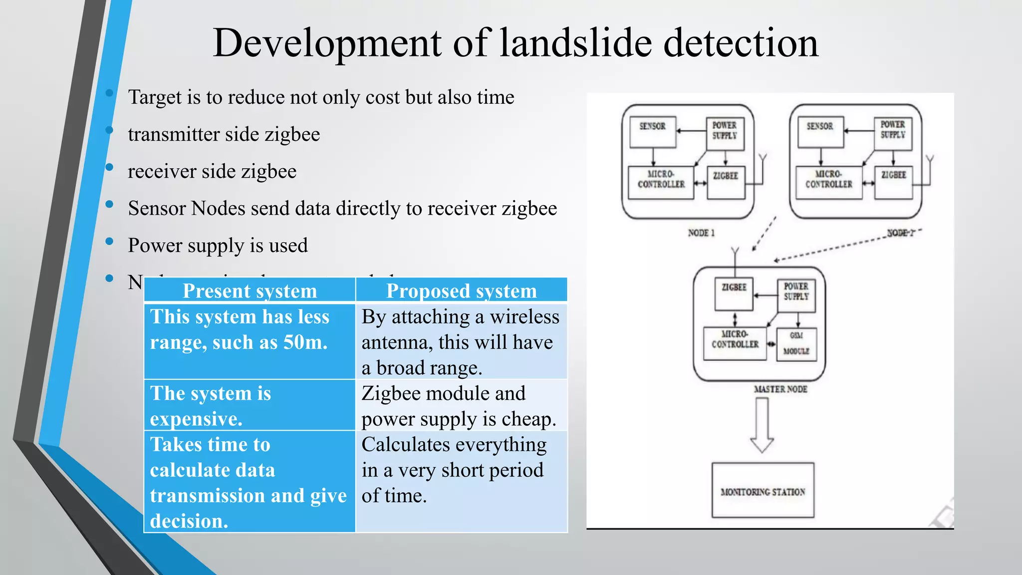
Development of landslidedetection • Target is to reduce not only cost but also time • transmitter side zigbee • receiver side zigbee • Sensor Nodes send data directly to receiver zigbee • Power supply is used • No human involvement neededPresent system Proposed system This system has less range, such as 50m. By attaching a wireless antenna, this will have a broad range. The system is expensive. Zigbee module and power supply is cheap. Takes time to calculate data transmission and give decision. Calculates everything in a very short period of time.
13.
Conclusion • This developmentprovides the experience of design, development, and deployment of a wireless sensor network for landslide detection. We plan to determine the optimal number of geophysical sensors and wireless sensor nodes with the hope of reducing the cost and energy consumption and thus increasing the lifetime of the network.