Download to read offline


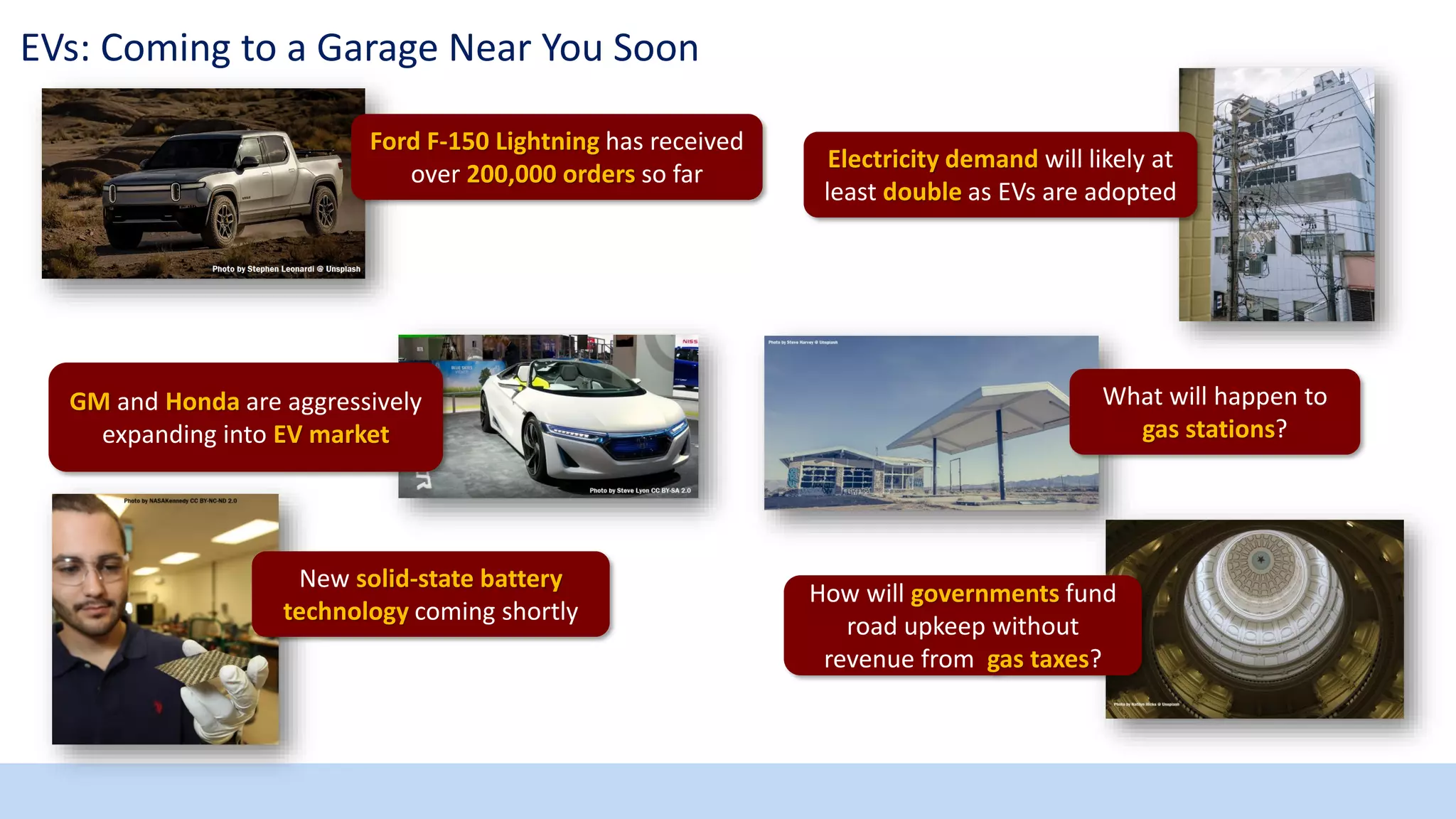
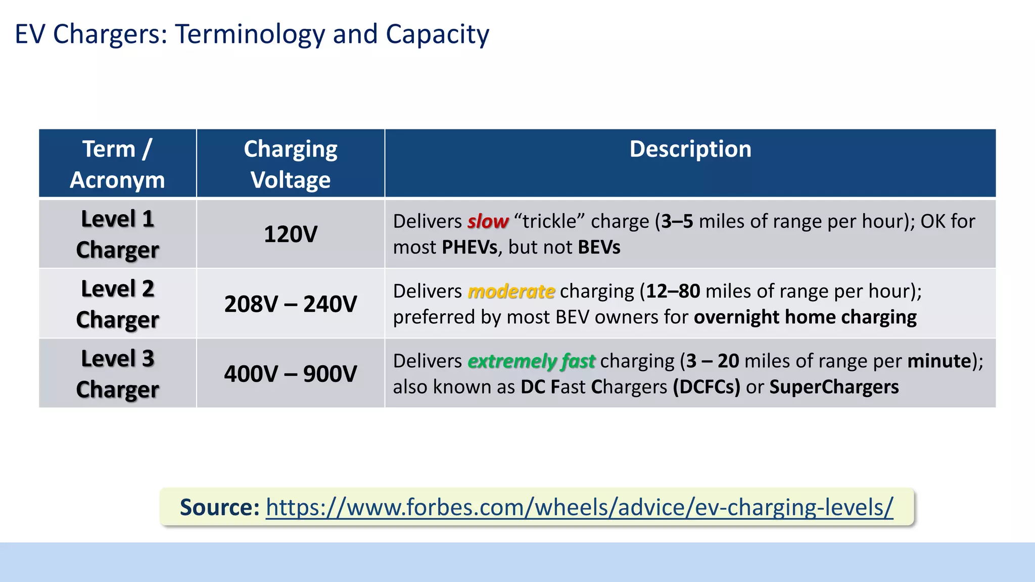
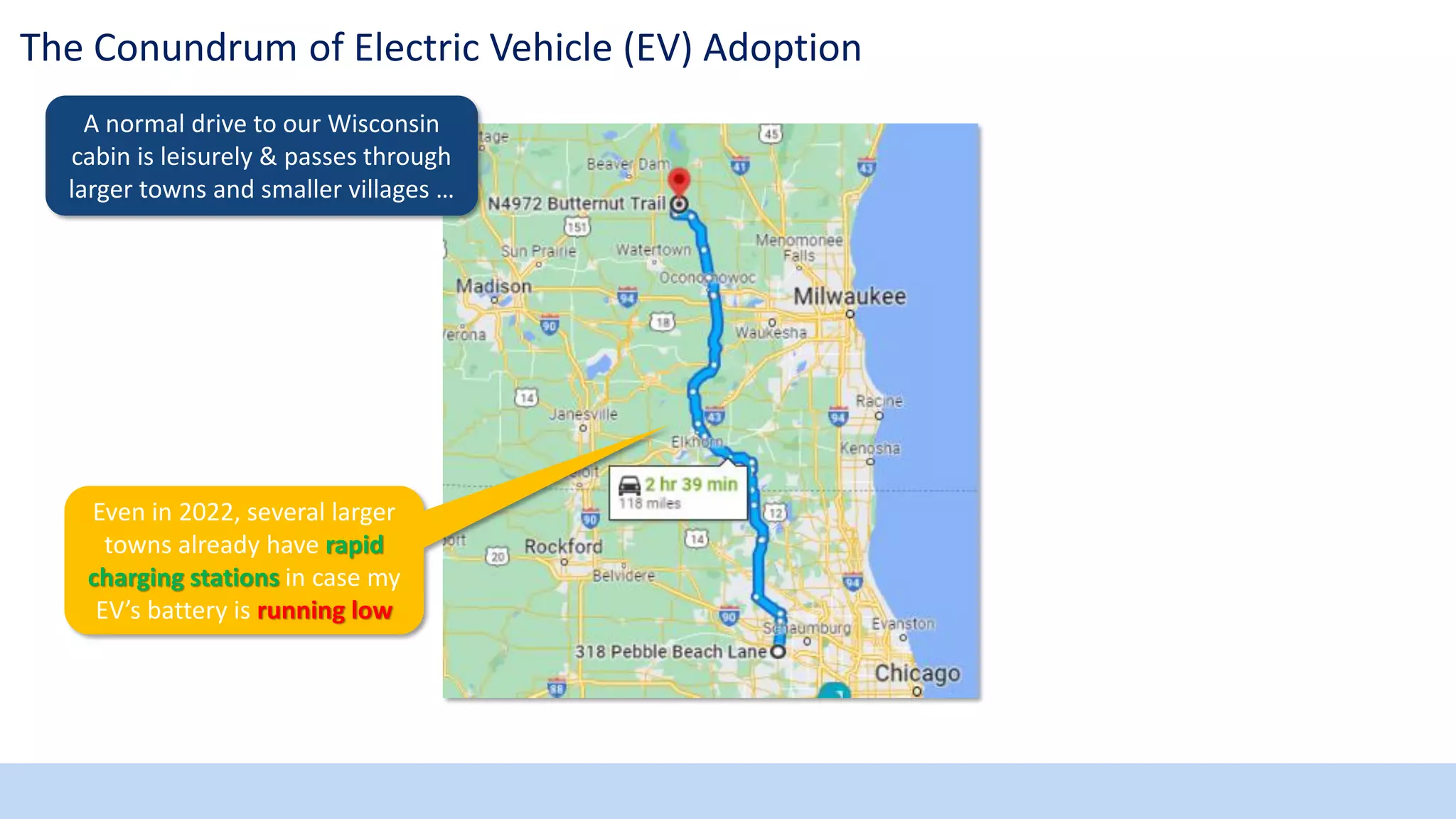
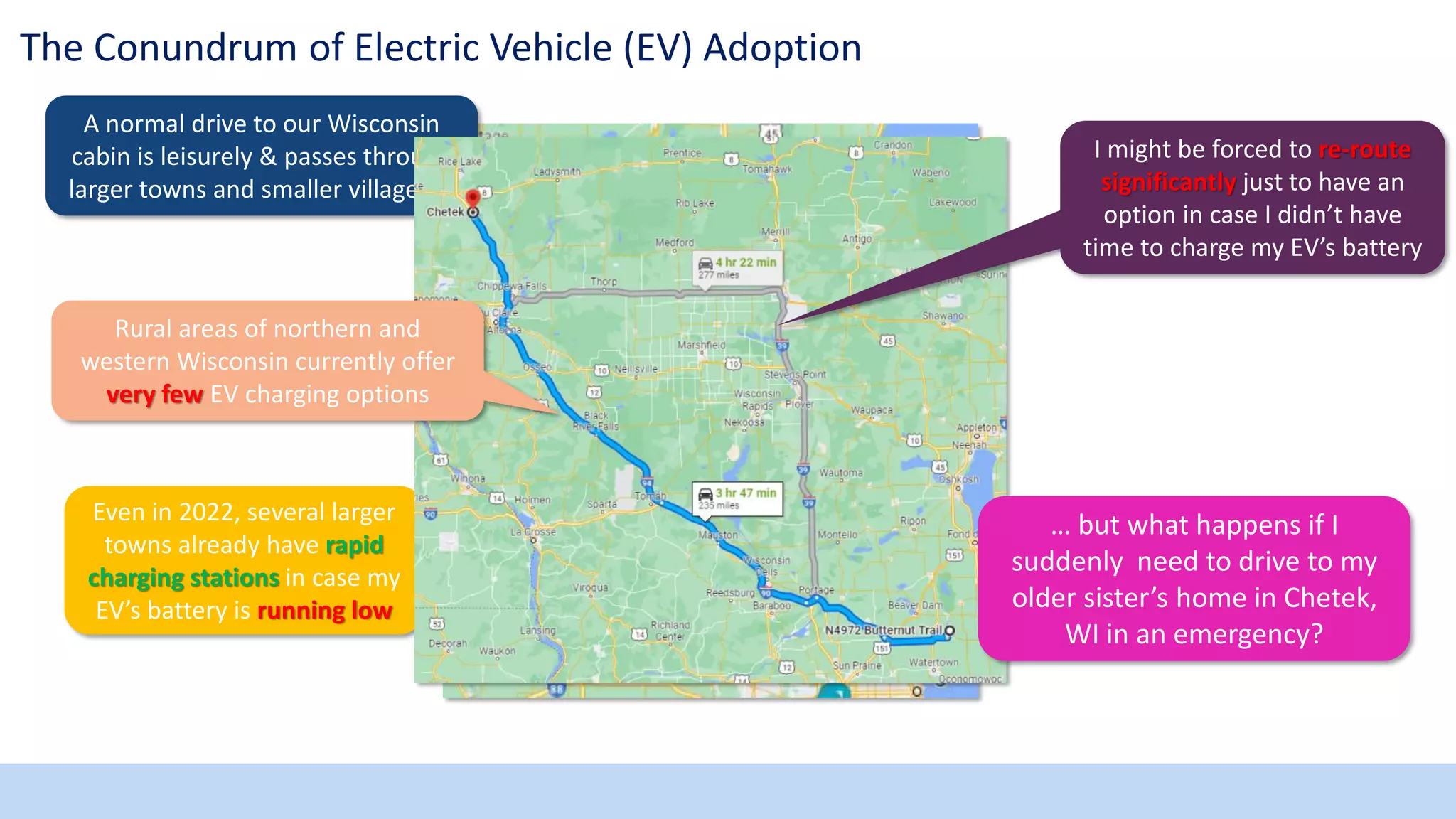
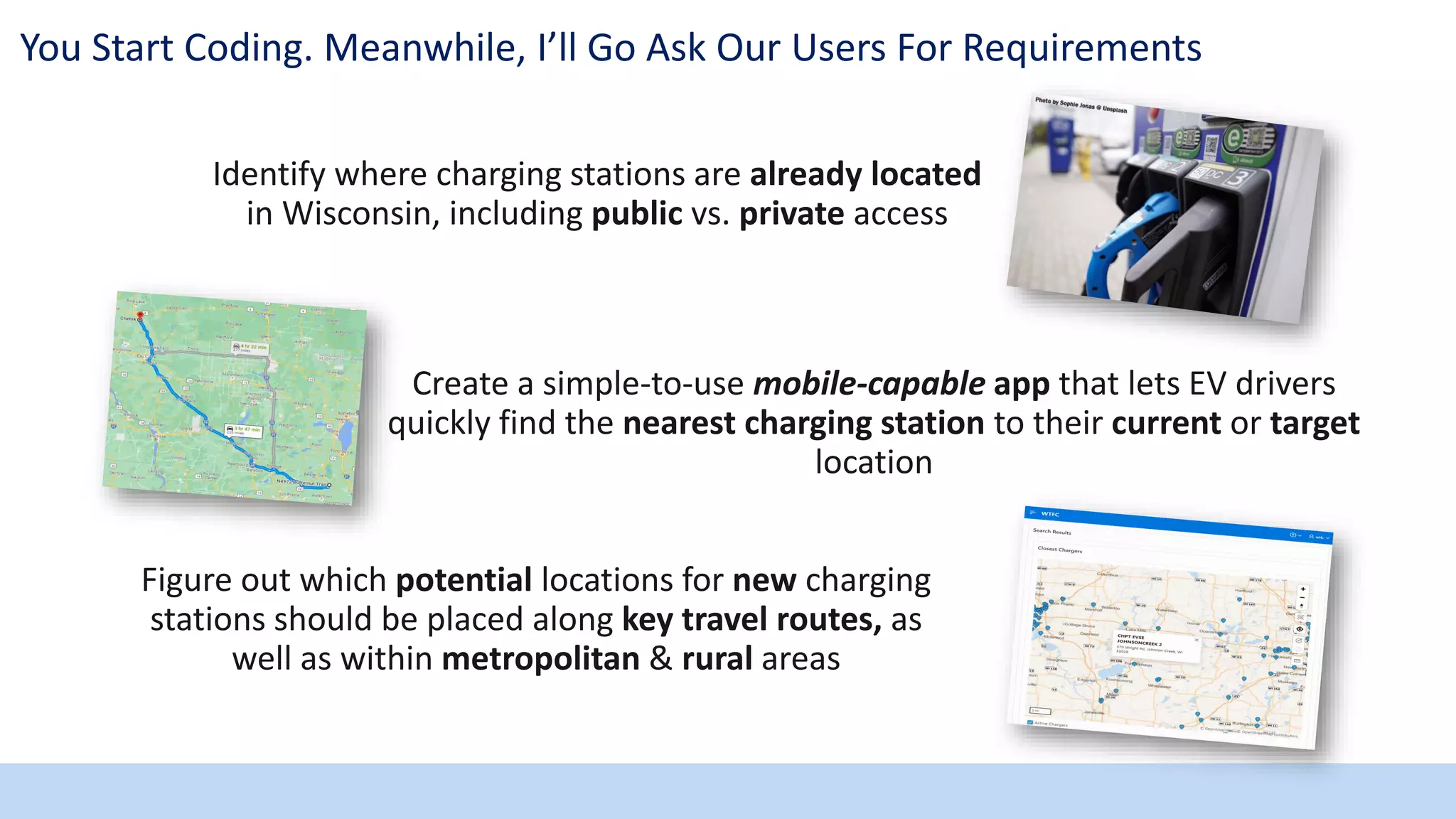
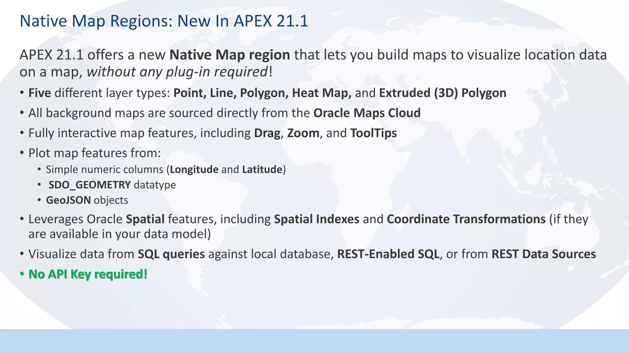
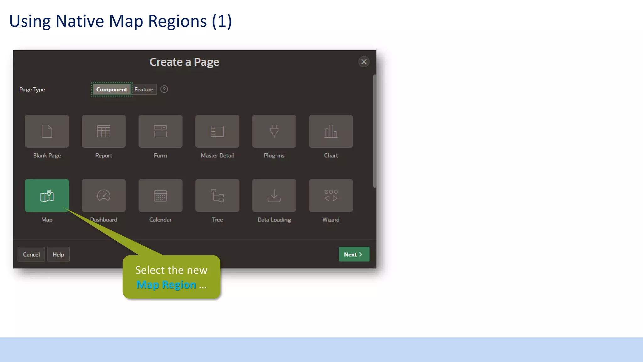
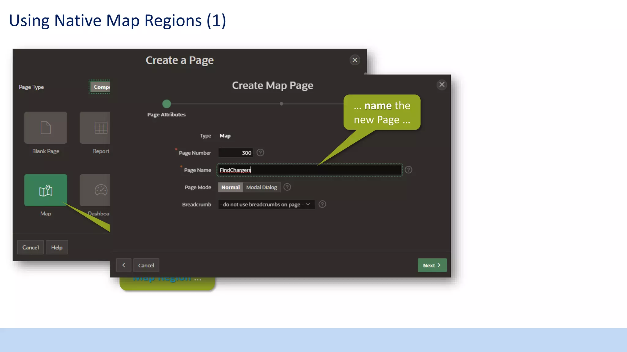
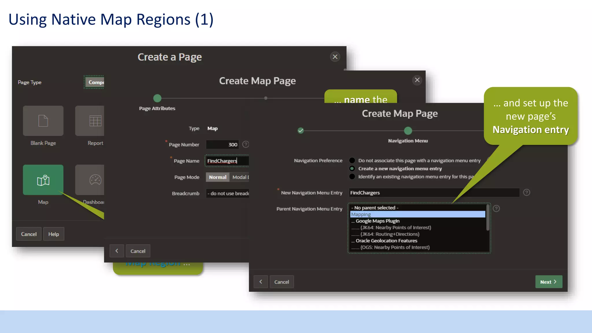
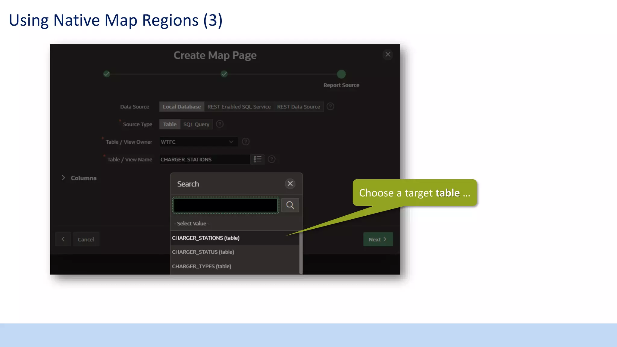
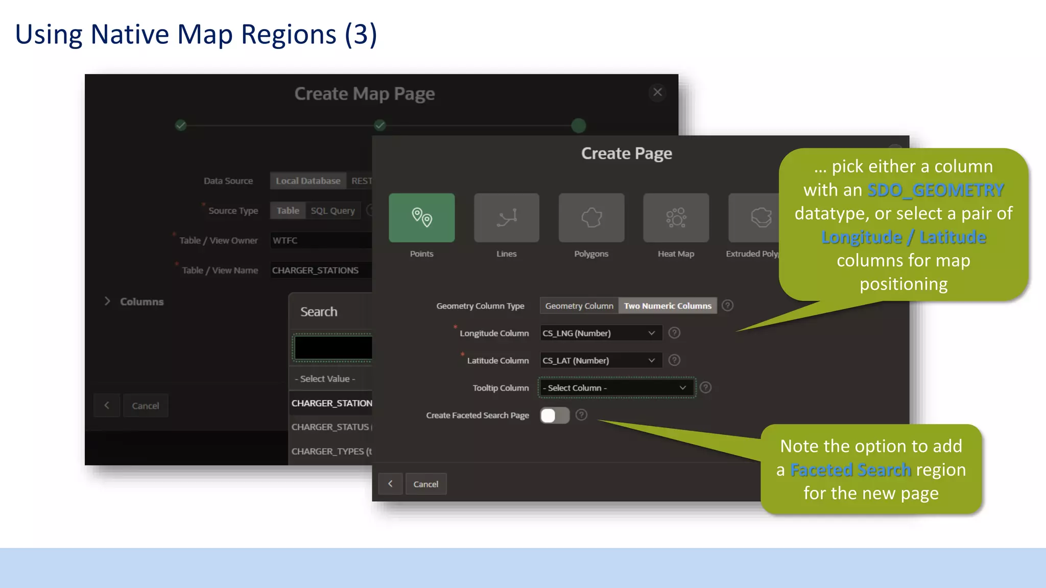
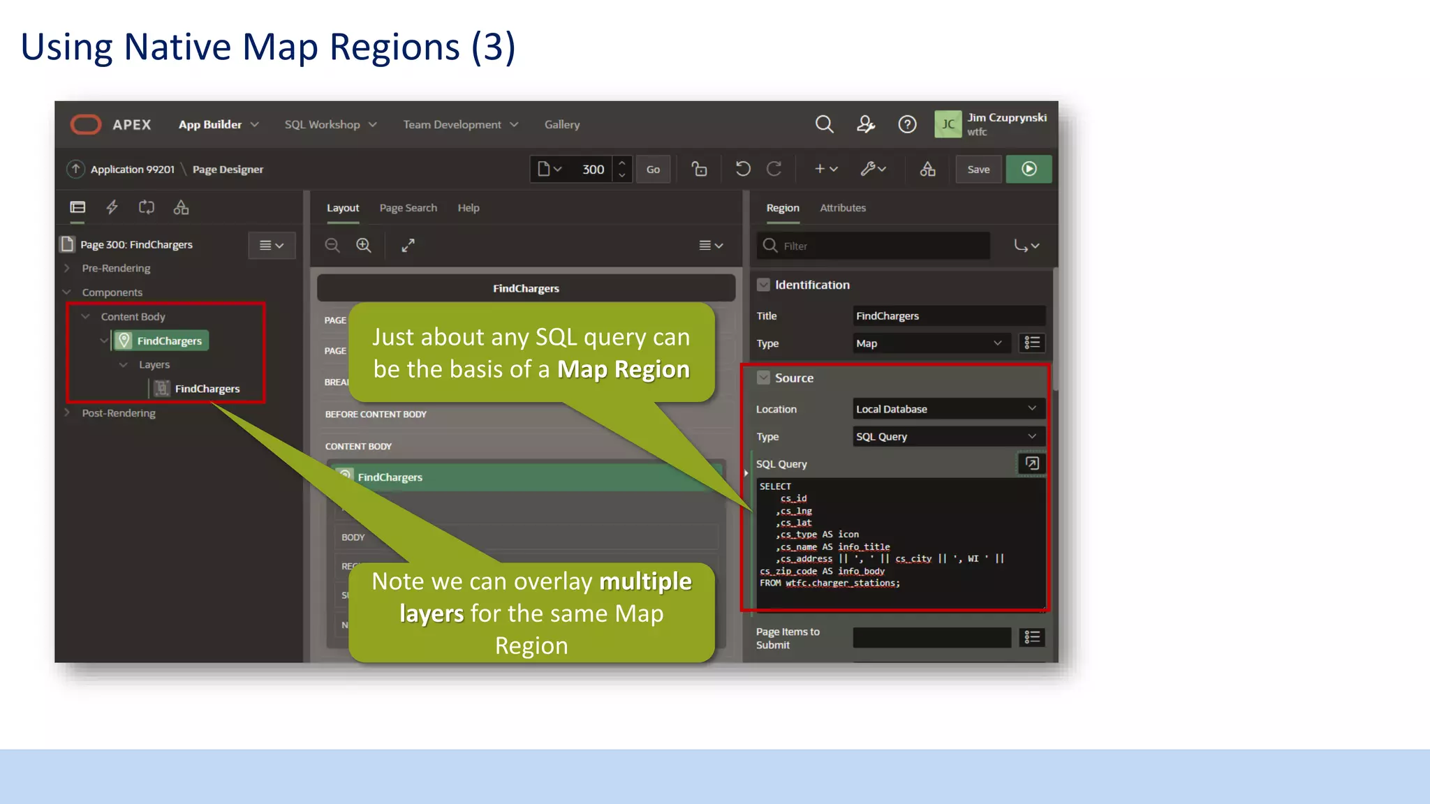
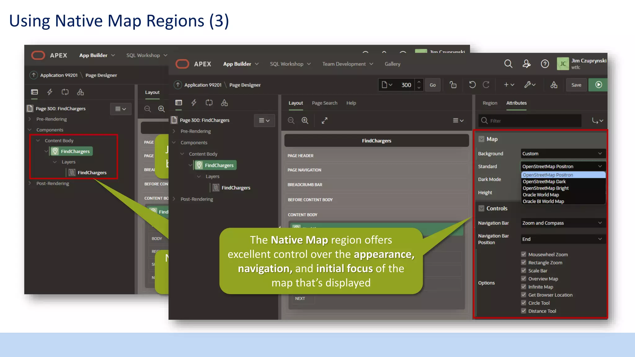
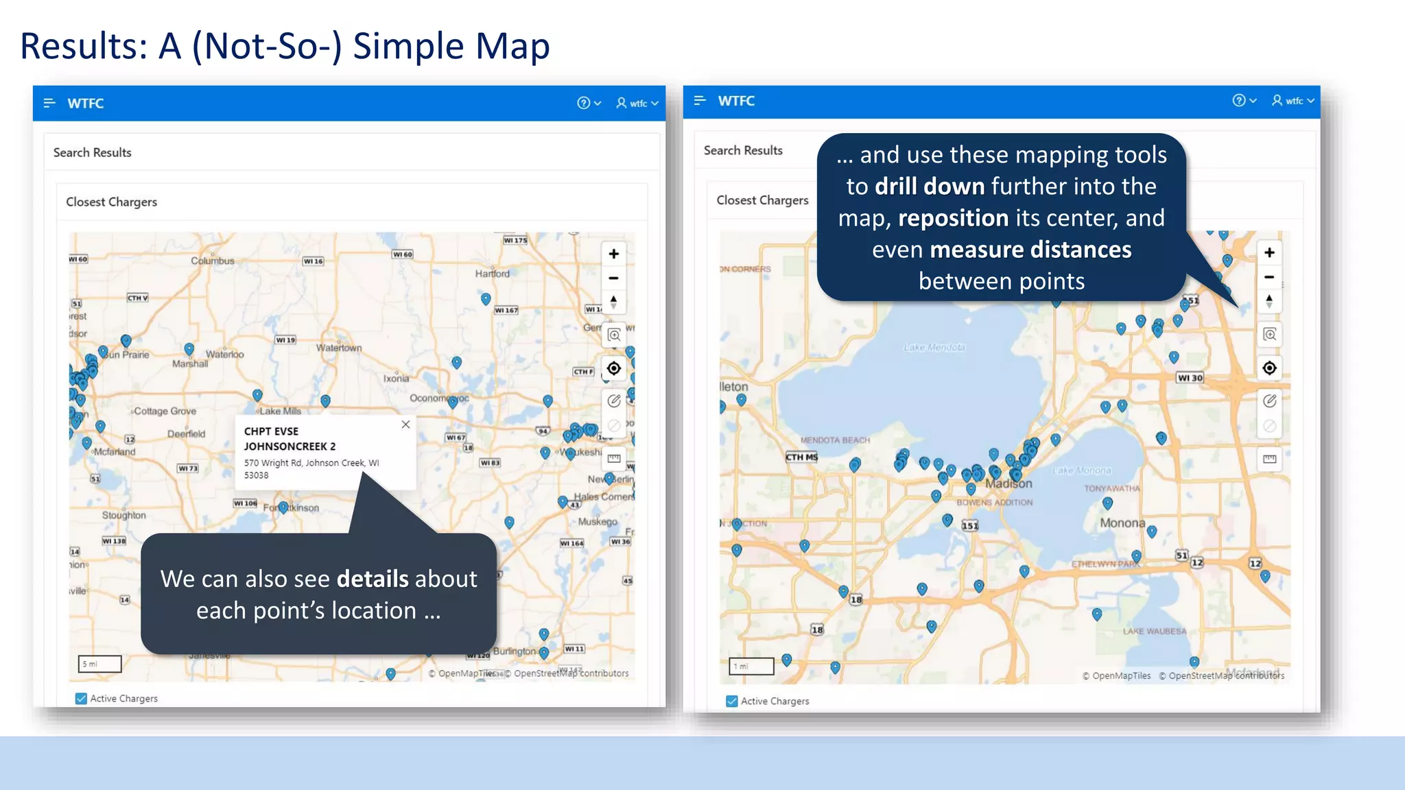
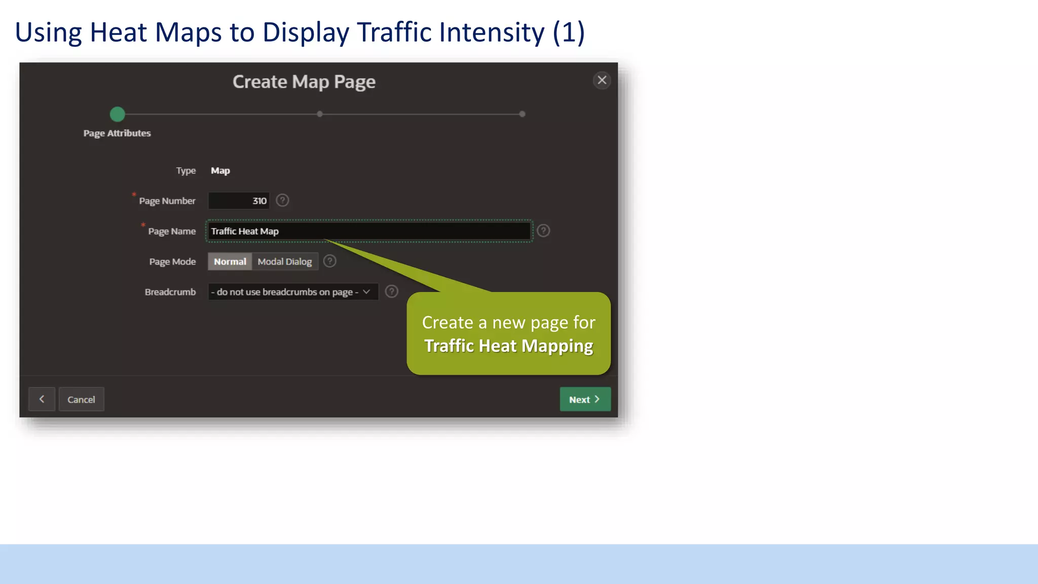
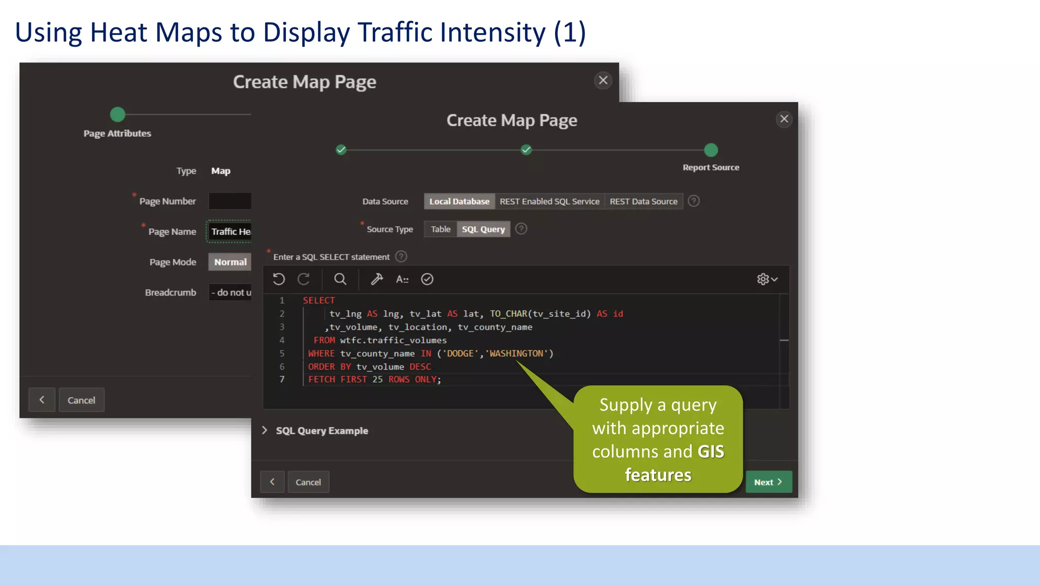
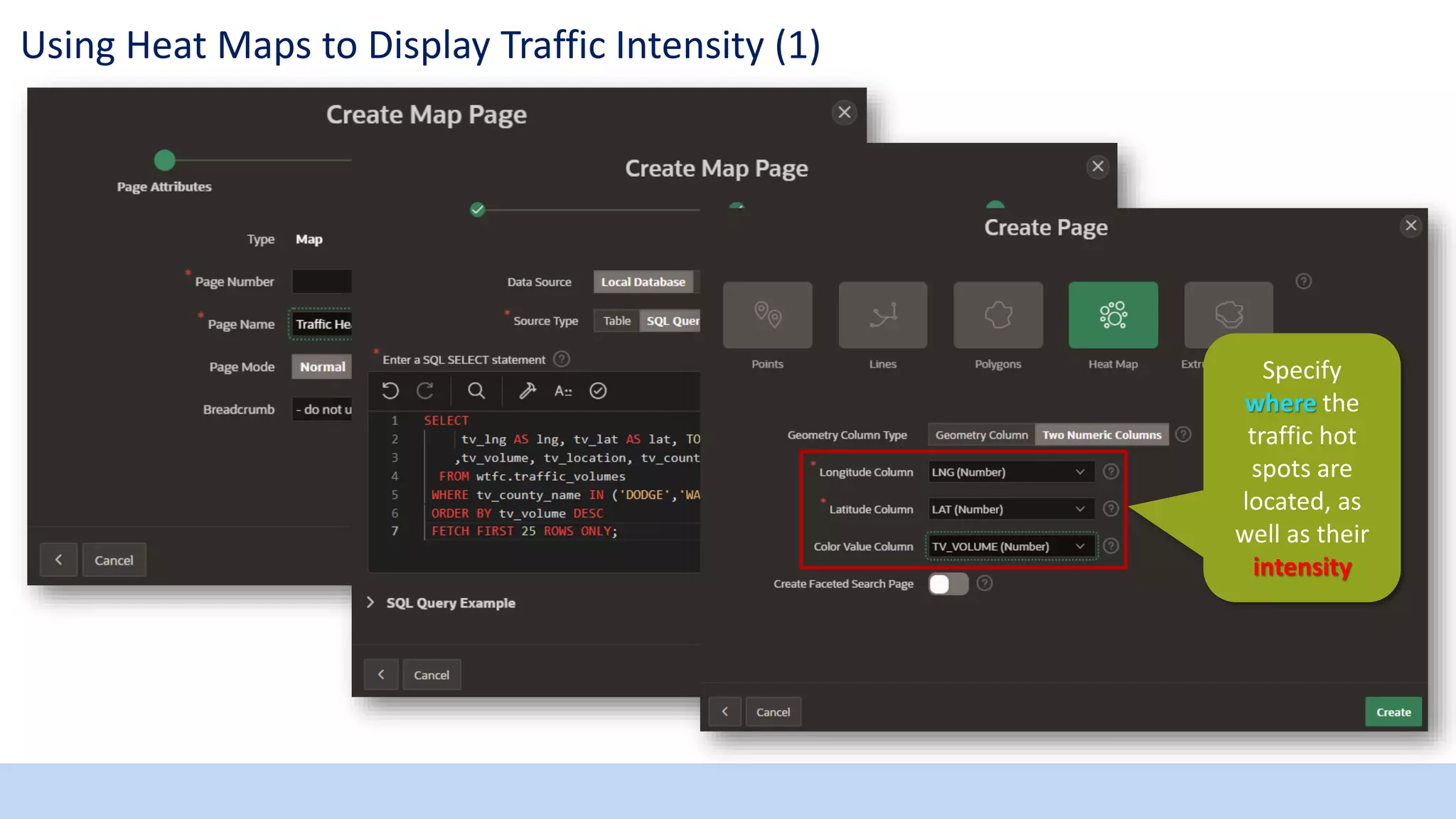
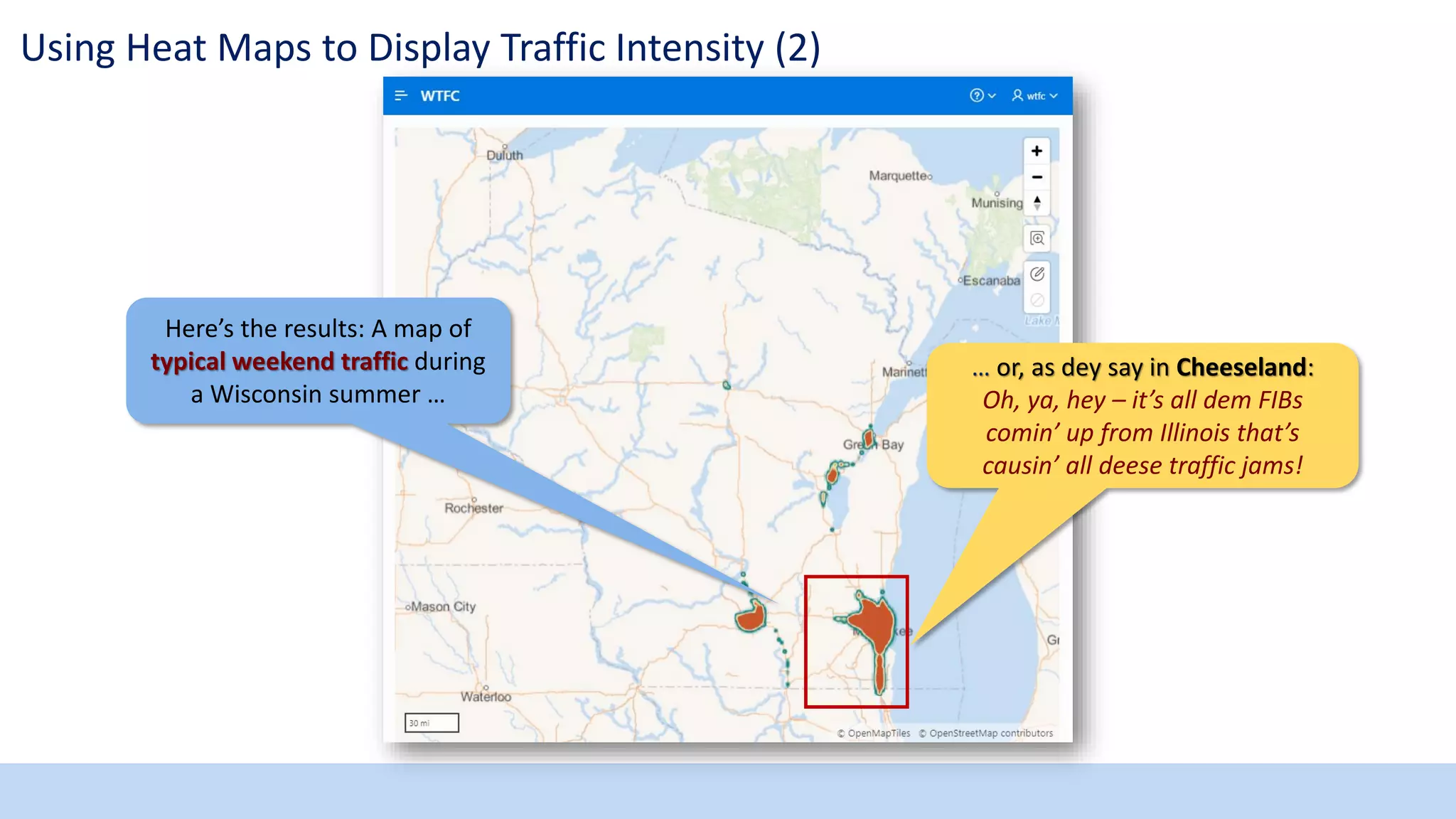
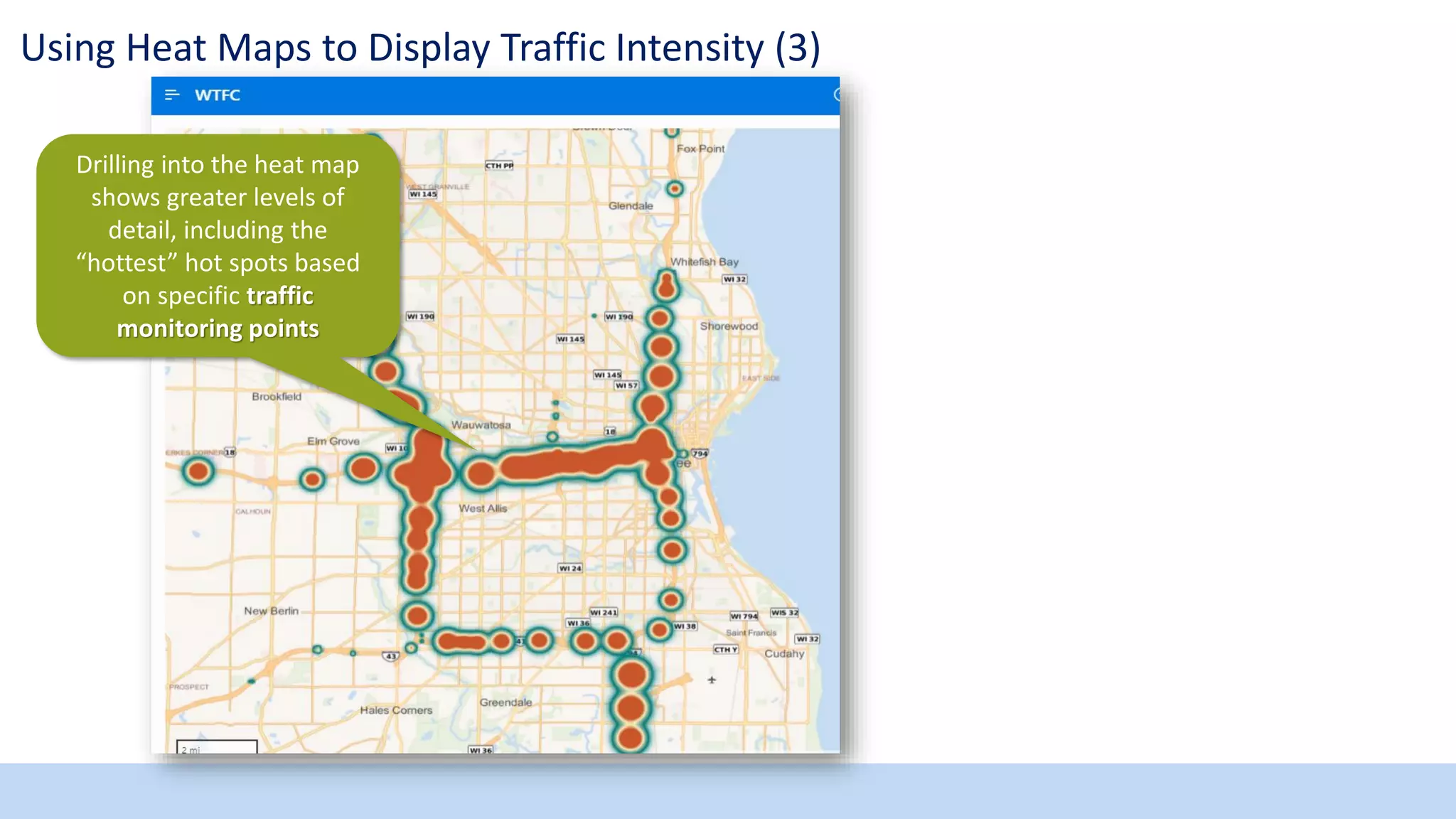
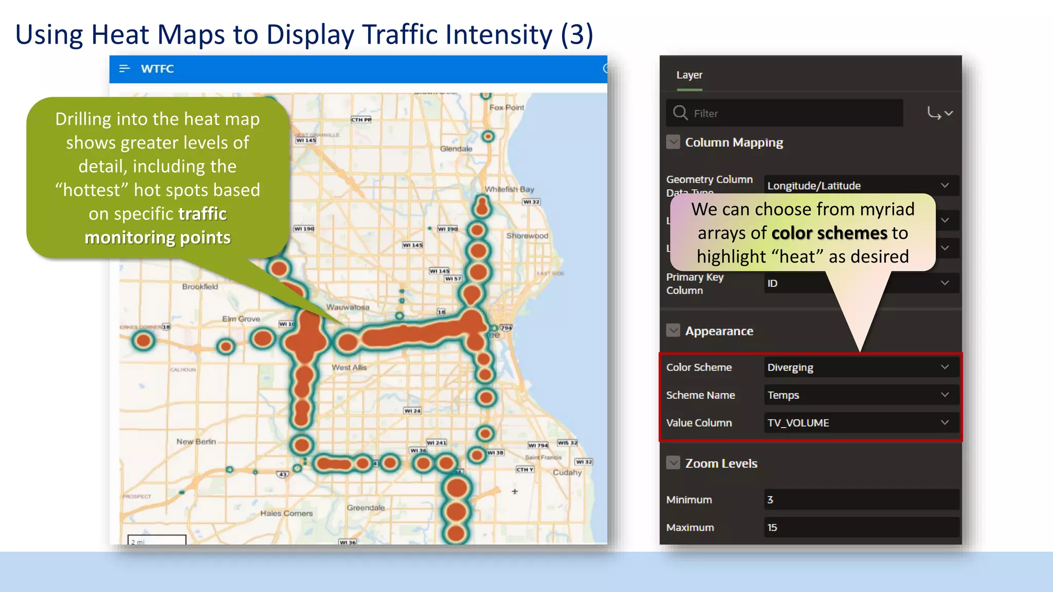
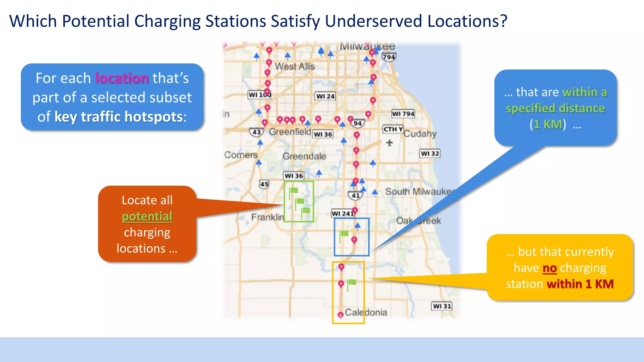
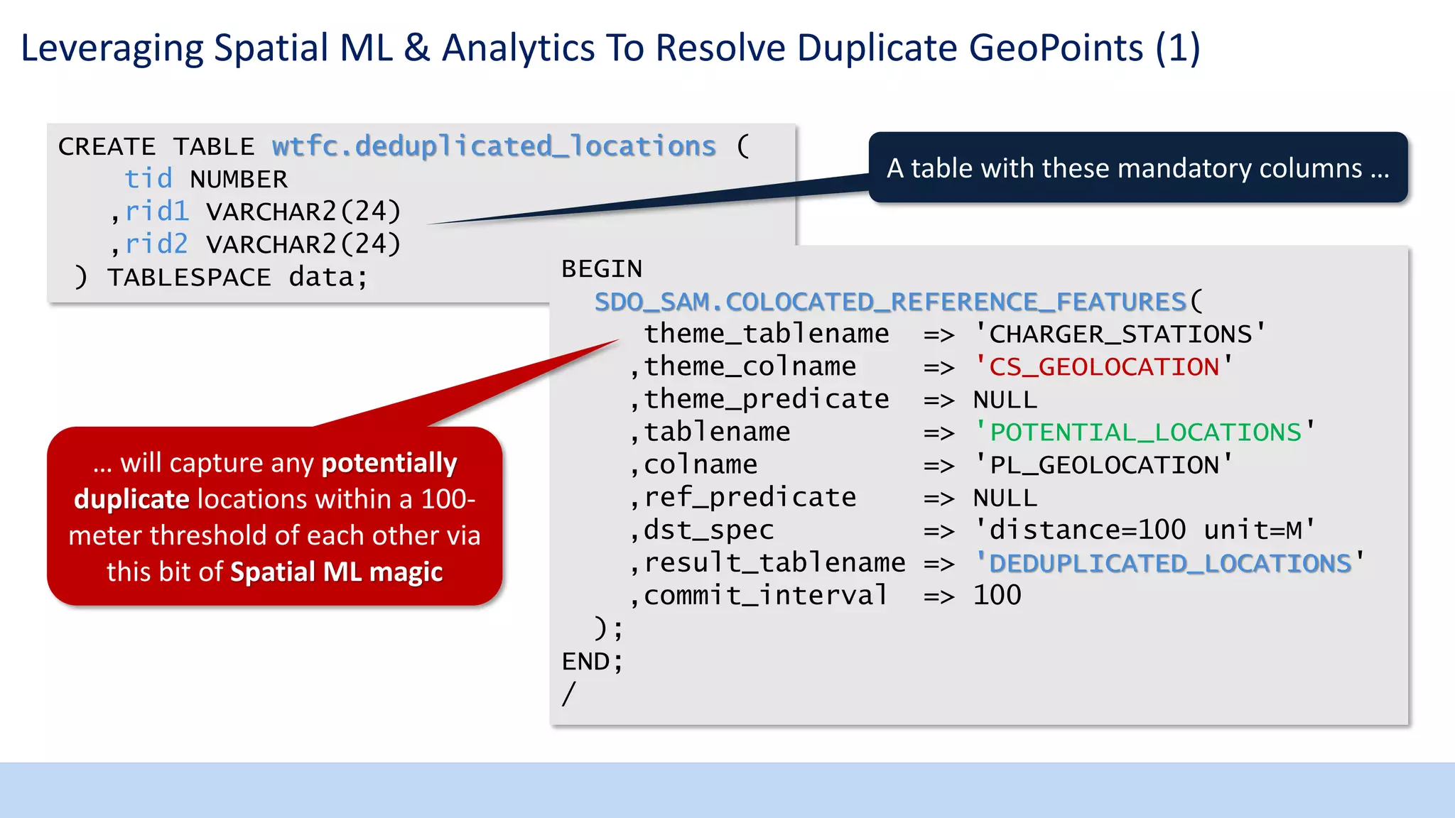
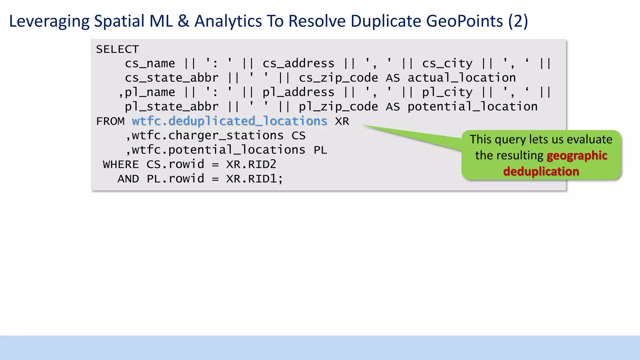
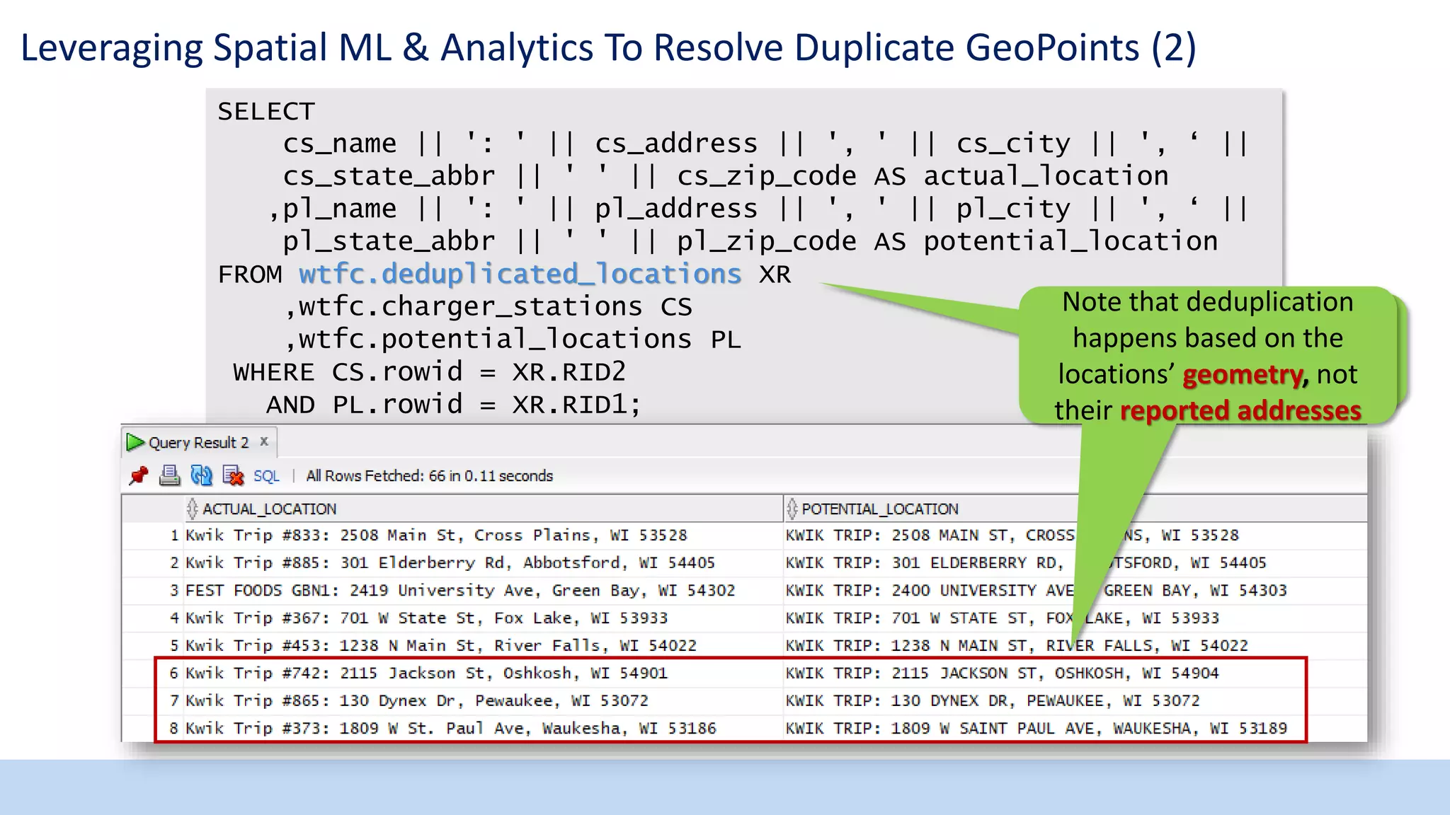
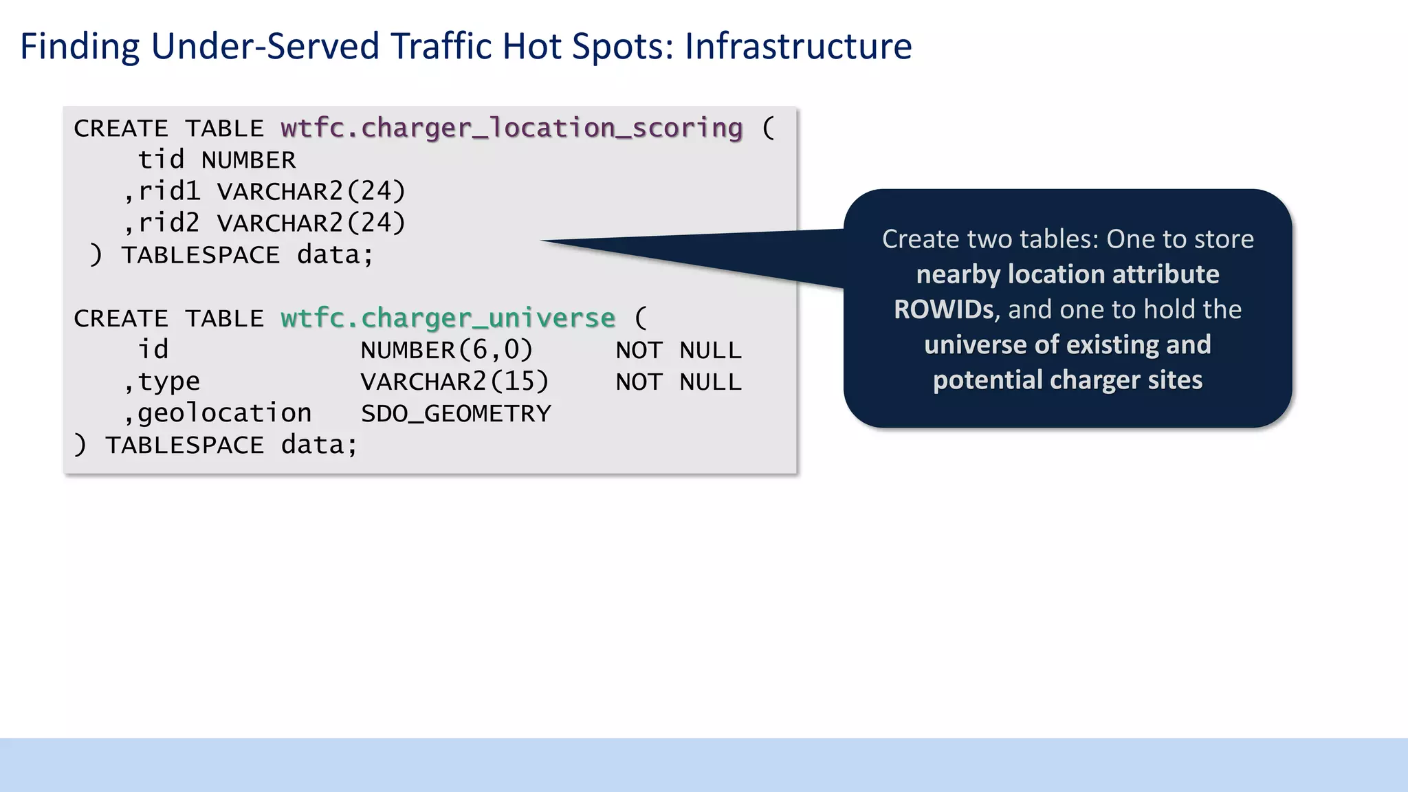
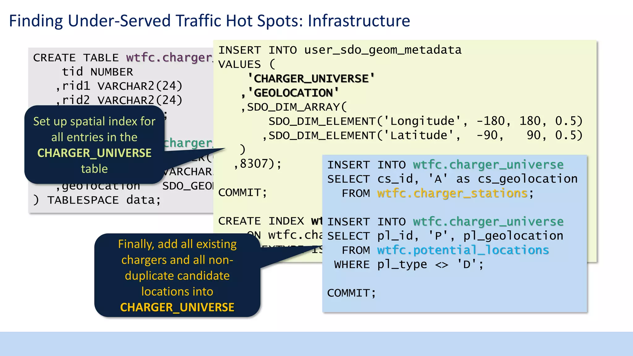
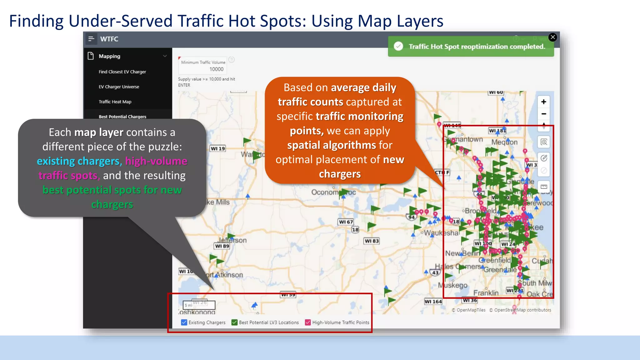
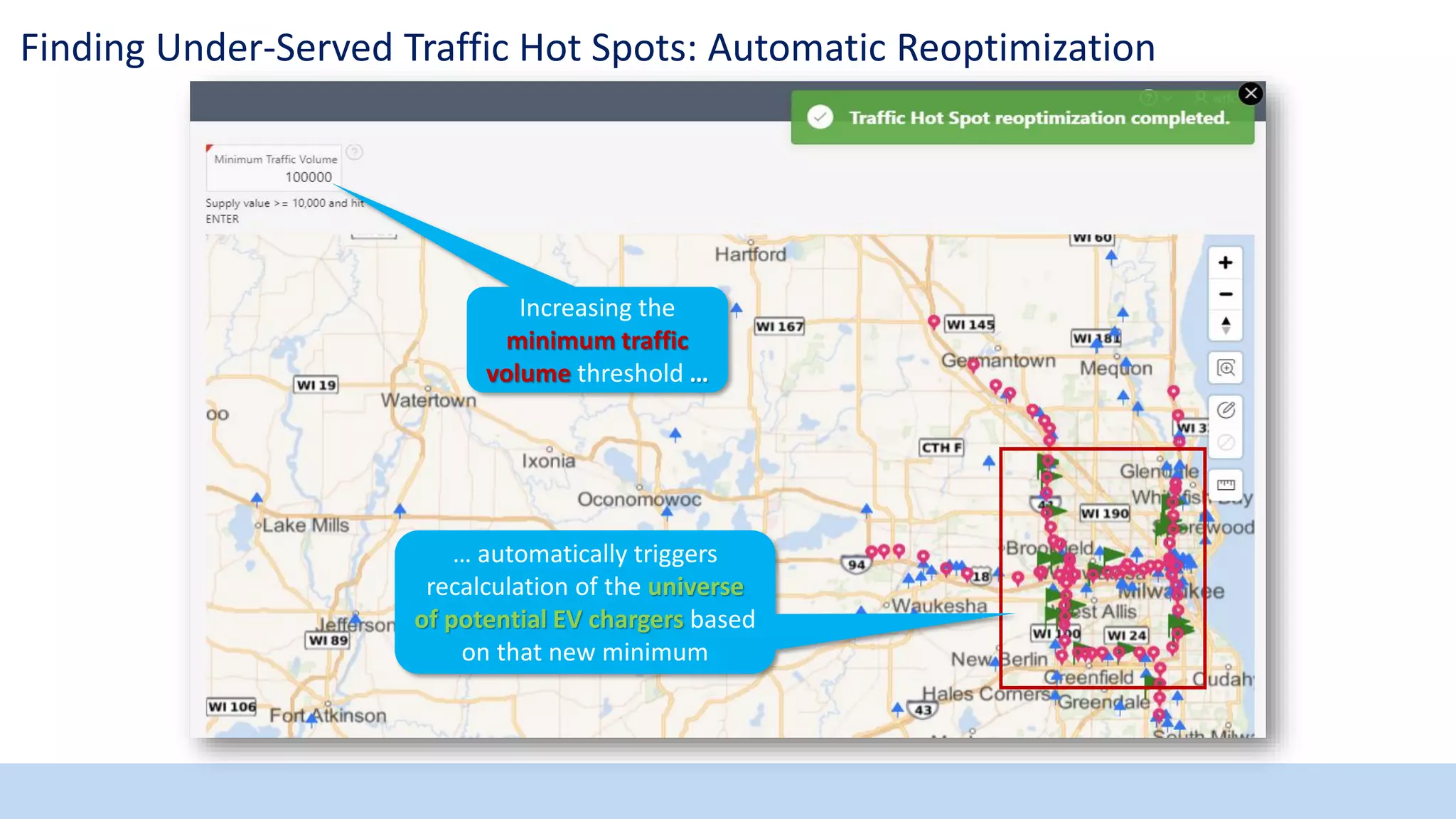
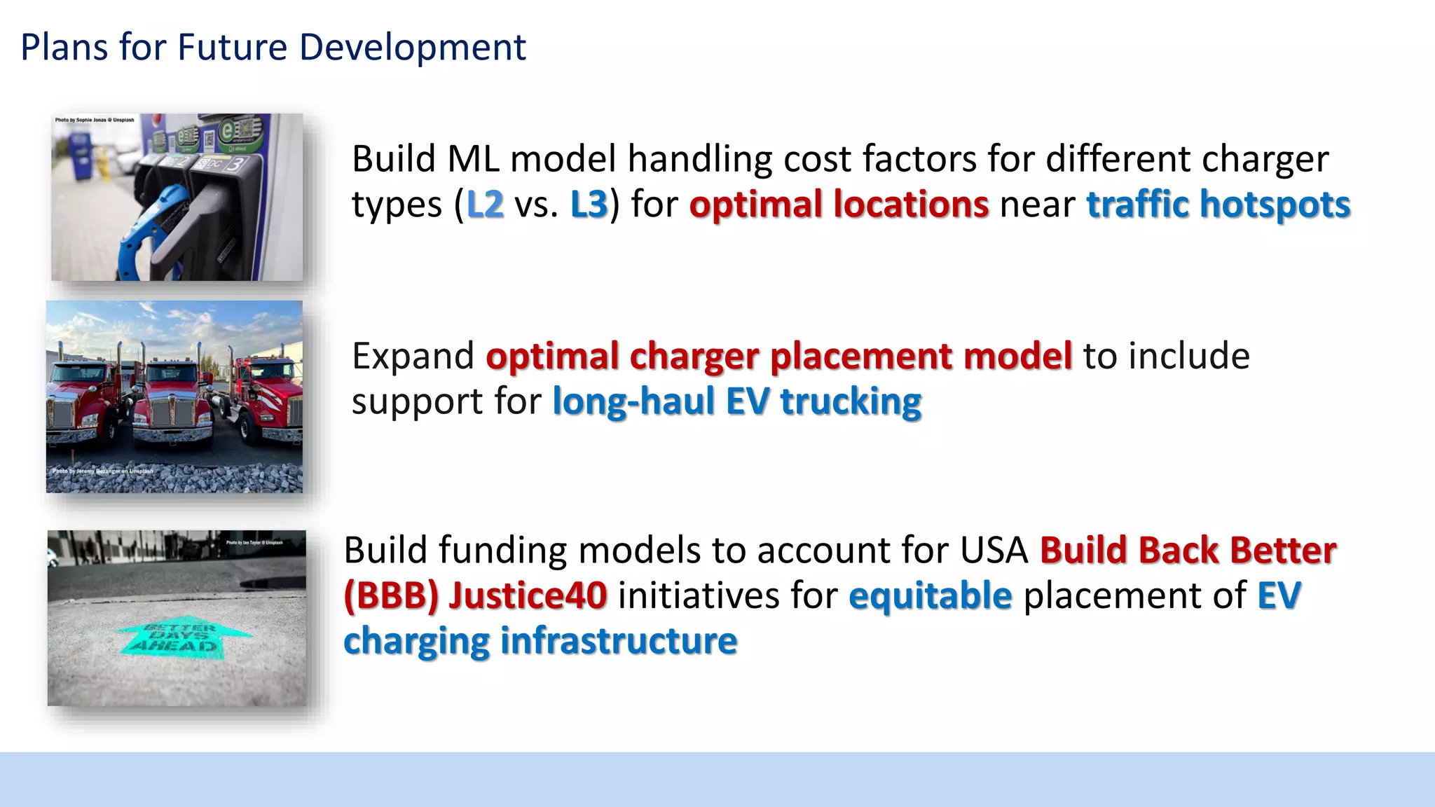

This document discusses using Oracle ML, analytics, and APEX to find optimal locations for electric vehicle charging stations. It begins by introducing the presenter and providing background on electric vehicles and charger terminology. It then outlines the challenge of ensuring adequate charging infrastructure, especially in rural areas. The document demonstrates how to use APEX's new native map region to visualize existing chargers and traffic hotspots. It shows how spatial ML and analytics can resolve duplicate geopoints and score potential new charger locations. The results are overlaid on interactive maps. Future plans include expanding the optimal placement model and developing funding models.